Soraya Hernández, Estudio Flamenco
Soraya Hernández, Estudio Flamenco is a school in Las Palmas, Gran Canaria. Soraya Hernández, Estudio Flamenco is situated nearby to the sports venue Club de Esgrima, Sala de Armas, as well as near Titán Gym.| Tap on a place to explore it |
Places of Interest Nearby
Highlights include Obelisk and Plaza de la Feria.

Plaza de la Feria
Park
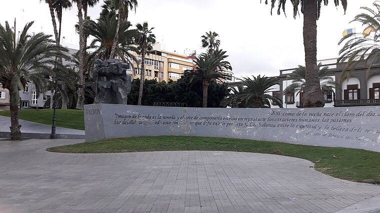
Photo: Beta15, CC BY-SA 4.0.
Plaza de la Feria is a park, which is situated 450 metres east of Soraya Hernández, Estudio Flamenco.
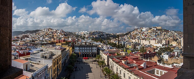
Centro Insular de Deportes
Stadium

Photo: Tolagorn, CC BY-SA 4.0.
Centro Insular de Deportes is an indoor arena in Las Palmas, Spain. It was the home arena of the Spanish ACB League professional basketball team Gran Canaria until 2014. The arena holds 5,200 people. Centro Insular de Deportes is situated 750 metres east of Soraya Hernández, Estudio Flamenco.
Places in the Area
Nearby places include Triana and Ciudad Jardín.


Soraya Hernández, Estudio Flamenco
- Type: School
- Category: education
- Location: Las Palmas, Las Palmas, Gran Canaria, Canary Islands, Spain, Iberia, Europe
- View on OpenStreetMap
Latitude
28.11384° or 28° 6′ 50″ northLongitude
-15.42514° or 15° 25′ 31″ westOpen location code
7CW64H7F+GWOpenStreetMap ID
node 4377205771OpenStreetMap feature
amenity=school
This page is based on OpenStreetMap, Wikidata, and Wikimedia Commons.
We’d love your help improving our open data sources. Thank you for contributing.
Satellite Map
Discover Soraya Hernández, Estudio Flamenco from above in high-definition satellite imagery.
Notable Places Nearby
Highlights include Club de Esgrima, Sala de Armas and Titán Gym.
Nearby Places
Explore places such as Smash Burger and Backara.
Gran Canaria: Must-Visit Destinations
Delve into Telde, Ingenio, Maspalomas, and Playa del Inglés.
Curious Schools to Discover
Uncover intriguing schools from every corner of the globe.
About Mapcarta. Data © OpenStreetMap contributors and available under the Open Database License". Text is available under the CC BY-SA 4.0 license, except for photos, directions, and the map. Photo: Gino maccanti, CC BY 2.0.