Les Taillards
Les Taillards is in Le Locle, Canton of Neuchâtel and has an elevation of 910 metres. Les Taillards is situated nearby to the scenic viewpoint Belevedère des Taillards, as well as near the passenger ship terminal Saut-du-Doubs.| Tap on a place to explore it |
Places of Interest Nearby
Highlights include Lac des Brenets and Saut du Doubs.
Lac des Brenets
Lake

Photo: Wikimedia, CC BY-SA 3.0.
Lac des Brenets or Lac de Chaillexon is a lake on the river Doubs on the border of Switzerland and France.
Saut du Doubs
Waterfall
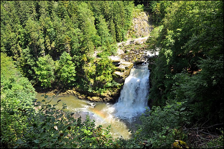
Photo: Wikimedia, CC BY-SA 2.0.
Saut du Doubs is a waterfall, which is situated 1¼ km northeast of Les Taillards.
Les Brenets railway station
Railway station

Photo: NAC, CC BY-SA 4.0.
Les Brenets railway station is a railway station in the municipality of Le Locle, in the Swiss canton of Neuchâtel. It is the western terminus of the 1,000 mm Le Locle–Les Brenets line of the Transports publics Neuchâtelois. Les Brenets railway station is situated 2 km southeast of Les Taillards.
Places in the Area
Nearby places include Les Brenets and La Chenalotte.
Les Brenets
Village

Photo: Roland Zumbuehl, CC BY 3.0.
Les Brenets is a former municipality in the canton of Neuchâtel in Switzerland. On 1 January 2021 the former municipality of Les Brenets merged into Le Locle.
La Chenalotte
Village

Photo: JGS25, CC BY-SA 4.0.
La Chenalotte is a commune in the Doubs department in the Bourgogne-Franche-Comté region in eastern France. La Chenalotte is situated 3 km north of Les Taillards.
Villers-le-Lac
Village

Photo: JGS25, CC BY-SA 4.0.
Villers-le-Lac is a commune in the Doubs department in the Bourgogne-Franche-Comté region in eastern France. Villers-le-Lac is situated 3 km southwest of Les Taillards.
Les Taillards
- Type: Sign
- Categories: information and tourism
- Location: Le Locle, Le Locle District, Canton of Neuchâtel, Western Switzerland, Switzerland, Central Europe, Europe
- View on OpenStreetMap
Latitude
47.08212° or 47° 4′ 56″ northLongitude
6.69804° or 6° 41′ 53″ eastElevation
910 metres (2,986 feet)Open location code
8FV83MJX+R6OpenStreetMap ID
node 4399562022OpenStreetMap feature
tourism=information
This page is based on OpenStreetMap, Wikidata, and Wikimedia Commons.
We’d love your help improving our open data sources. Thank you for contributing.
Satellite Map
Discover Les Taillards from above in high-definition satellite imagery.
Places with the Same Name
Discover other places named “Les Taillards”.
Notable Places Nearby
Highlights include Belevedère des Taillards and Saut-du-Doubs.
Nearby Places
Explore places such as Les Taillards and Studio Pandia.
Western Switzerland: Must-Visit Destinations
Delve into Geneva, Lausanne, Lake Geneva, and Fribourg.
Curious Places to Discover
Uncover intriguing places from every corner of the globe.
About Mapcarta. Data © OpenStreetMap contributors and available under the Open Database License". Text is available under the CC BY-SA 4.0 license, except for photos, directions, and the map. Photo: specialdj, CC BY 3.0.