Kimi & Co
Kimi & Co is a clothing store in Cayenne, Guyane which is located on Avenue du Président Monnerville. Kimi & Co is situated nearby to the government office Honorary Consulate of England, as well as near the public building Antenne CAF.| Tap on a place to explore it |
Places of Interest Nearby
Highlights include Musée départemental Alexandre Franconie and Immeuble Vitalo.
Musée départemental Alexandre Franconie
Museum

Photo: Lydav, CC BY-SA 3.0.
Musée départemental Alexandre Franconie is a museum, which is situated 210 metres northwest of Kimi & Co.
Immeuble Vitalo
Historic building
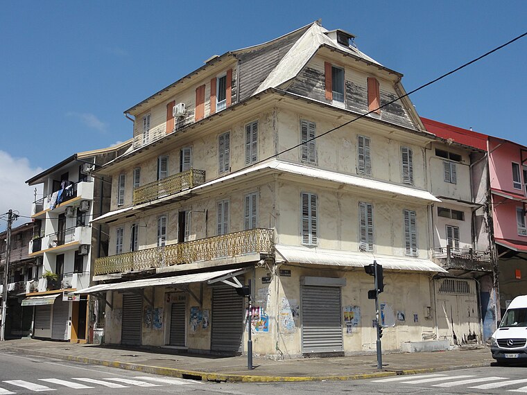
Photo: Aandrem, CC BY-SA 4.0.
Immeuble Vitalo is a historic building, which is situated 220 metres east of Kimi & Co.
Bibliothèque Départementale Franconie
Library

Photo: Cayambe, CC BY-SA 3.0.
Bibliothèque Départementale Franconie is a library, which is situated 200 metres northwest of Kimi & Co.
Places in the Area
Nearby places include Remire-Montjoly and Matoury.
Remire-Montjoly
Town

Photo: Lebrouillard, CC BY-SA 3.0.
Remire-Montjoly is a commune of French Guiana, an overseas region and department of France located on the northeast coast of South America. Remire-Montjoly is a suburb of Cayenne, the capital préfecture and largest city of French Guiana. Remire-Montjoly is situated 7 km southeast of Kimi & Co.
Matoury
Town

Photo: Bernard DUPONT, CC BY-SA 2.0.
Matoury is a commune of French Guiana, an overseas region and department of France located in South America. Matoury is a southern suburb of Cayenne, the préfecture and largest city of French Guiana. Cayenne – Félix Eboué Airport, the main international airport of French Guiana, is located in the commune of Matoury. Matoury is situated 10 km south of Kimi & Co.
Kimi & Co
- Type: Clothing store
- Address: Avenue du Président Monnerville
- Category: shop
- Location: Cayenne, Arrondissement of Cayenne, Guyane, French Guiana, South America
- View on OpenStreetMap
Latitude
4.93698° or 4° 56′ 13″ northLongitude
-52.33309° or 52° 19′ 59″ westOpen location code
68P9WMP8+QQOpenStreetMap ID
node 4422894103OpenStreetMap feature
shop=clothes
This page is based on OpenStreetMap, Wikidata, and Wikimedia Commons.
We’d love your help improving our open data sources. Thank you for contributing.
Satellite Map
Discover Kimi & Co from above in high-definition satellite imagery.
Notable Places Nearby
Highlights include Honorary Consulate of England and Antenne CAF.
Nearby Places
Explore places such as Nouh Chaia and Mascote.
French Guiana: Must-Visit Destinations
Delve into Cayenne, Kourou, Saint-Laurent-du-Maroni, and Saint-Georges.
Curious Clothing Stores to Discover
Uncover intriguing clothing stores from every corner of the globe.
About Mapcarta. Data © OpenStreetMap contributors and available under the Open Database License". Text is available under the CC BY-SA 4.0 license, except for photos, directions, and the map. Photo: Wikimedia, CC0.