Chignin Bretelle
Chignin Bretelle is a tollbooth in Myans, Arrondissement of Chambéry, Auvergne-Rhône-Alpes. Chignin Bretelle is situated nearby to the grassland Carrefour de Chignin, as well as near the winery Domaine Jean Perrier & Fils.| Tap on a place to explore it |
Places of Interest Nearby
Highlights include Sanctuaire Notre-Dame de Myans and Montmélian station.
Sanctuaire Notre-Dame de Myans
Church
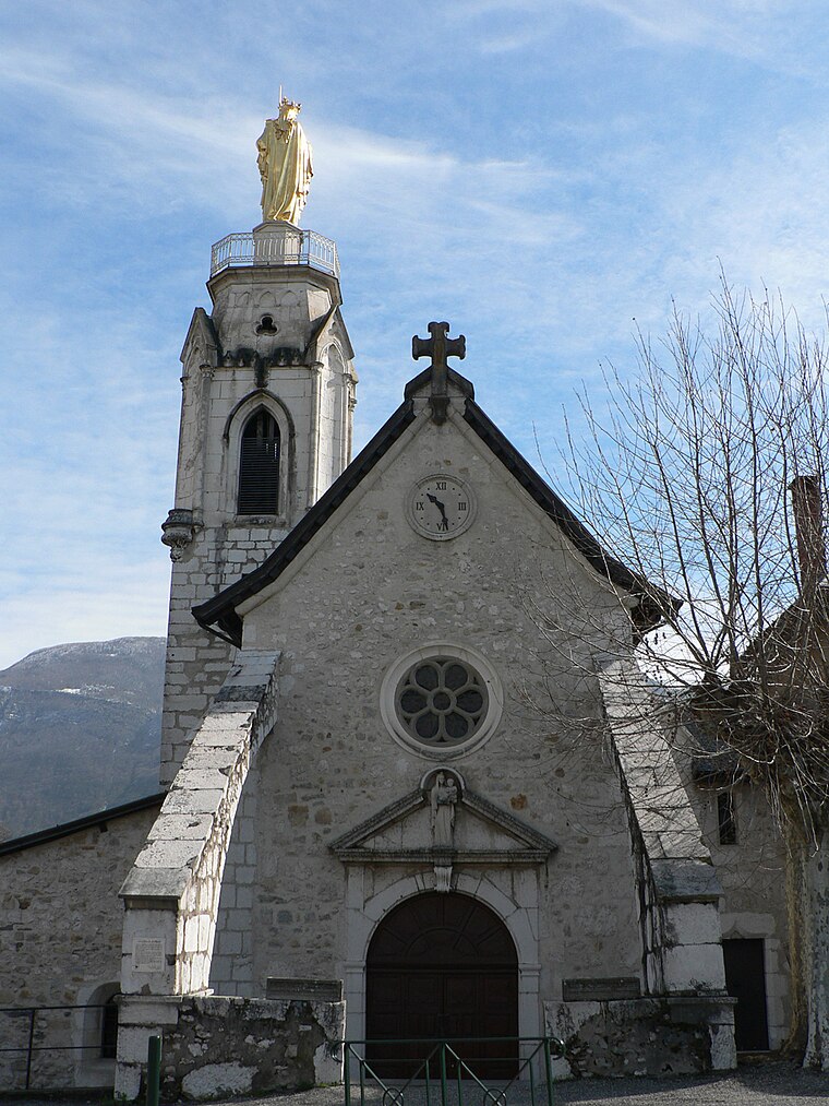
Photo: Badhy, CC BY-SA 4.0.
Sanctuaire Notre-Dame de Myans is a church, which is situated 1¼ km west of Chignin Bretelle.
Montmélian station
Railway station

Photo: Wikimedia, CC BY-SA 3.0.
Montmélian station is a railway station located in Montmélian, Savoie, south-eastern France. The station is located on the Culoz–Modane railway and Grenoble–Montmélian railway. The train services are operated by SNCF. Montmélian station is situated 3½ km east of Chignin Bretelle.
Église Saint-Maurice des Marches
Church
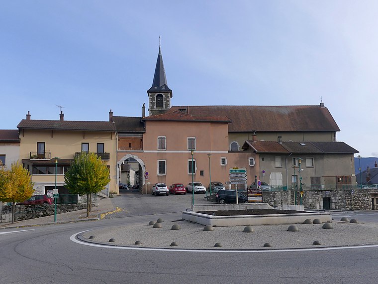
Photo: Wikimedia, CC BY-SA 4.0.
Église Saint-Maurice des Marches is a church, which is situated 1½ km south of Chignin Bretelle.
Places in the Area
Nearby places include Montmélian and La Thuile.
Montmélian
Village

Photo: Wikimedia, CC BY-SA 3.0.
Montmélian is a commune in the Savoie department in the Auvergne-Rhône-Alpes region in south-eastern France. Montmélian station has rail connections to Grenoble, Modane, Bourg-Saint-Maurice and Chambéry. Montmélian is situated 4½ km east of Chignin Bretelle.
La Thuile
Village

Photo: Wikimedia, CC BY-SA 3.0.
La Thuile is a commune in the Savoie department in the Auvergne-Rhône-Alpes region in south-eastern France. La Thuile is situated 4½ km northeast of Chignin Bretelle.
Arbin
Village

Photo: Wikimedia, CC BY-SA 3.0.
Arbin is a commune in the Savoie department in the Auvergne-Rhône-Alpes region in south-eastern France. It lies southeast of Chambéry. Arbin is situated 5 km east of Chignin Bretelle.
Chignin Bretelle
- Type: Tollbooth
- Category: transportation
- Location: Myans, Arrondissement of Chambéry, Savoie, Auvergne-Rhône-Alpes, France, Europe
- View on OpenStreetMap
Latitude
45.51332° or 45° 30′ 48″ northLongitude
6.0028° or 6° 0′ 10″ eastOperator
AREAOpen location code
8FQ8G273+84OpenStreetMap ID
node 4423761565
This page is based on OpenStreetMap, Wikidata, and Wikimedia Commons.
We’d love your help improving our open data sources. Thank you for contributing.
Satellite Map
Discover Chignin Bretelle from above in high-definition satellite imagery.
Places with the Same Name
Discover other places named “Chignin Bretelle”.
Notable Places Nearby
Highlights include Carrefour de Chignin and Domaine Jean Perrier & Fils.
Nearby Places
Explore places such as Chignin Barrière and Péage de Chignin.
Savoie: Must-Visit Destinations
Delve into Chambéry, Aix-les-Bains, Val-d’Isère, and Bourg-Saint-Maurice.
Curious Tollbooths to Discover
Uncover intriguing tollbooths from every corner of the globe.
About Mapcarta. Data © OpenStreetMap contributors and available under the Open Database License". Text is available under the CC BY-SA 4.0 license, except for photos, directions, and the map. Photo: Mrhugues, CC BY-SA 3.0.