Vögel im Mäckingerbachtal
Vögel im Mäckingerbachtal is in Hagen, Arnsberg, North Rhine-Westphalia. Vögel im Mäckingerbachtal is situated nearby to the playground Experimentierfeld Wasser, as well as near Schmieden in der Massenproduktion.| Tap on a place to explore it |
Places of Interest Nearby
Highlights include Hagen Open-air Museum and Osthaus-Museum Hagen.
Hagen Open-air Museum
Theme park
 The Hagen Westphalian Open-Air Museum is a museum at Hagen in the southeastern Ruhr area, North Rhine-Westphalia, Germany. Hagen Open-air Museum is situated 120 metres northeast of Vögel im Mäckingerbachtal.
Osthaus-Museum Hagen
Museum
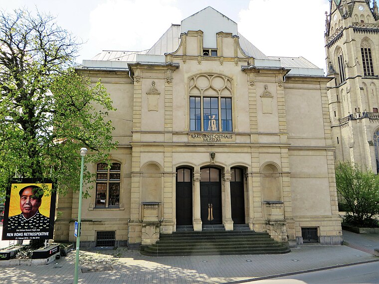
Photo: Bärwinkel,Klaus, CC BY 3.0.
The Karl Ernst Osthaus-Museum is an art museum in Hagen, North Rhine-Westphalia, Germany. The center of the museum is a building whose interior was designed by Henry van de Velde to house Karl Ernst Osthaus' art collection, open to the public as the Museum Folkwang. Osthaus-Museum Hagen is situated 3½ km north of Vögel im Mäckingerbachtal.

Places in the Area
Nearby places include Lange Riege and Delstern.
Lange Riege
Neighborhood

Photo: Meister, CC BY-SA 3.0.
Lange Riege is a neighborhood, which is situated 2½ km north of Vögel im Mäckingerbachtal.
Delstern
Suburb

Photo: Meister, CC BY-SA 3.0.
Delstern is a suburb, which is situated 2½ km northeast of Vögel im Mäckingerbachtal.
Walddorf-Siedlung
Neighborhood

Photo: Bärwinkel,Klaus, CC BY-SA 4.0.
Walddorf-Siedlung is a neighborhood, which is situated 3½ km north of Vögel im Mäckingerbachtal.
Vögel im Mäckingerbachtal
- Type: Sign
- Categories: information and tourism
- Location: Hagen, Arnsberg, Ruhr, North Rhine-Westphalia, Germany, Central Europe, Europe
- View on OpenStreetMap
Latitude
51.32459° or 51° 19′ 29″ northLongitude
7.48228° or 7° 28′ 56″ eastOpen location code
9F398FFJ+RWOpenStreetMap ID
node 4428025353OpenStreetMap feature
tourism=information
This page is based on OpenStreetMap, Wikidata, and Wikimedia Commons.
We’d love your help improving our open data sources. Thank you for contributing.
Satellite Map
Discover Vögel im Mäckingerbachtal from above in high-definition satellite imagery.
Notable Places Nearby
Highlights include Experimentierfeld Wasser and Schmieden in der Massenproduktion.
Nearby Places
Explore places such as Rennofen and Hammerwerk.
Ruhr: Must-Visit Destinations
Delve into Dortmund, Essen, Duisburg, and Bochum.
Curious Places to Discover
Uncover intriguing places from every corner of the globe.
About Mapcarta. Data © OpenStreetMap contributors and available under the Open Database License". Text is available under the CC BY-SA 4.0 license, except for photos, directions, and the map. Photo: Ennepetaler86, CC BY-SA 3.0.