Norberg Livs
Norberg Livs is a convenience store in Norberg socken, Norberg, Västmanland County. Norberg Livs is situated nearby to Engelbrektsparken, as well as near the museum Elvisboden.| Tap on a place to explore it |
Places of Interest Nearby
Highlights include Elsa Andersons konditori and Norberg Church.
Elsa Andersons konditori
Café
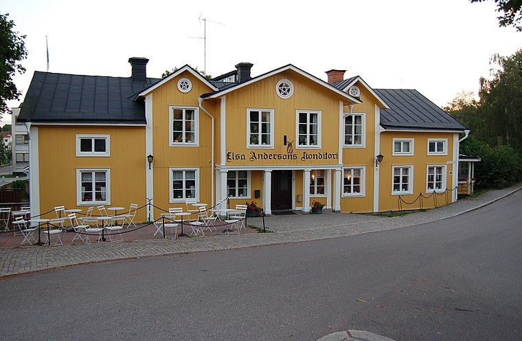
Photo: FriskoKry, CC BY-SA 3.0.
Elsa Andersons konditori is a café, which is situated 330 metres northwest of Norberg Livs.

Places in the Area
Nearby places include Karbenning and Fagersta.
Karbenning
Hamlet

Photo: Boberger, CC BY-SA 4.0.
Karbenning is a hamlet, which is situated 9 km east of Norberg Livs.
Fagersta

Photo: Wikimedia, Public domain.
Fagersta is a town in northern Västmanland in Sweden. It's the central town of Fagersta municipality, also covered in this article.
Norberg Livs
- Type: Convenience store
- Categories: shop and food
- Location: Norberg socken, Norberg, Norberg Municipality, Västmanland County, Sweden, Nordic countries, Europe
- View on OpenStreetMap
Latitude
60.06194° or 60° 3′ 43″ northLongitude
15.92628° or 15° 55′ 35″ eastOpen location code
9FGQ3W6G+QGOpenStreetMap ID
node 4430286507OpenStreetMap feature
shop=convenience
This page is based on OpenStreetMap, Wikidata, and Wikimedia Commons.
We’d love your help improving our open data sources. Thank you for contributing.
Satellite Map
Discover Norberg Livs from above in high-definition satellite imagery.
Notable Places Nearby
Highlights include Engelbrektsparken and Elvisboden.
Nearby Places
Explore places such as La Gondola Pizzeria and Vårdcentralen.
Sweden: Must-Visit Destinations
Delve into Stockholm, Uppsala, Gothenburg, and Malmö.
Curious Convenience Stores to Discover
Uncover intriguing convenience stores from every corner of the globe.
About Mapcarta. Data © OpenStreetMap contributors and available under the Open Database License". Text is available under the CC BY-SA 4.0 license, except for photos, directions, and the map. Photo: Wikimedia, CC BY-SA 3.0.