Las Crucitas
Las Crucitas is a school in Santa Bárbara Department, Honduras. Las Crucitas is situated nearby to the town San Pedro Zacapa, as well as near Concepción del Sur.| Tap on a place to explore it |
Places in the Area
Nearby places include San Pedro Zacapa and Concepción del Sur.
San Pedro Zacapa
Town

Photo: Wikimedia, Public domain.
San Pedro Zacapa is a municipality in the Honduran department of Santa Bárbara. San Pedro Zacapa is situated 3½ km southeast of Las Crucitas.
Concepción del Sur
Town
Concepción del Sur is a municipality in the Honduran department of Santa Bárbara. Concepción del Sur is situated 4 km north of Las Crucitas.
San Francisco de Ojuera
Town
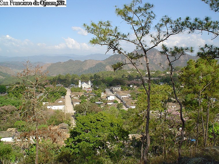
Photo: 1ednp, CC BY-SA 2.5.
San Francisco de Ojuera is a municipality in the Honduran department of Santa Bárbara. San Francisco de Ojuera is situated 6 km southwest of Las Crucitas.
Las Crucitas
- Type: School
- Category: education
- Location: Santa Bárbara Department, Honduras, Central America, North America
- View on OpenStreetMap
Latitude
14.76938° or 14° 46′ 10″ northLongitude
-88.14578° or 88° 8′ 45″ westOpen location code
766HQV93+QMOpenStreetMap ID
node 4465662389OpenStreetMap feature
amenity=school
This page is based on OpenStreetMap, Wikidata, and Wikimedia Commons.
We’d love your help improving our open data sources. Thank you for contributing.
Satellite Map
Discover Las Crucitas from above in high-definition satellite imagery.
In Other Languages
“Las Crucitas” goes by many names.
- Spanish: “Las Crucitas”
Places with the Same Name
Discover other places named “Las Crucitas”.
Notable Places Nearby
Highlights include Cementeruio de San Pedro Zacapa and parque.
Nearby Places
Explore places such as #aigorm and colegio.
Honduras: Must-Visit Destinations
Delve into Tegucigalpa, San Pedro Sula, Roatán, and La Ceiba.
Curious Places to Discover
Uncover intriguing places from every corner of the globe.
About Mapcarta. Data © OpenStreetMap contributors and available under the Open Database License". Text is available under the CC BY-SA 4.0 license, except for photos, directions, and the map. Photo: Wikimedia, CC0.