Le Treset
Le Treset is a hamlet in Auffay, Arrondissement of Dieppe, Normandy. Le Treset is situated nearby to the village Sévis, as well as near La Crique.| Tap on a place to explore it |
Places of Interest
Highlights include Château de Bosmelet.
Château de Bosmelet
Castle
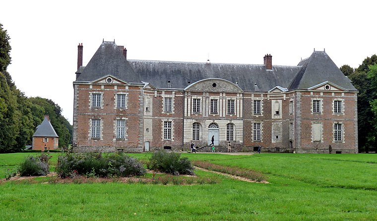
Photo: Paubry, CC BY-SA 3.0.
Château de Bosmelet is a castle, which is situated 3½ km west of Le Treset.
Places in the Area
Nearby places include Bellencombre and Bracquetuit.
Bellencombre
Village

Photo: Wikimedia, CC BY-SA 4.0.
Bellencombre is a commune in the Seine-Maritime department in the Normandy region in northern France. Bellencombre is situated 3½ km east of Le Treset.
Bracquetuit
Village

Photo: Wikimedia, CC BY-SA 4.0.
Bracquetuit is a commune in the Seine-Maritime department in the Normandy region in northern France. Bracquetuit is situated 4½ km south of Le Treset.
Beaumont-le-Hareng
Village
Beaumont-le-Hareng is a commune in the Seine-Maritime department in the Normandy region in northern France. Beaumont-le-Hareng is situated 5 km southeast of Le Treset.
Le Treset
- Type: Hamlet
- Category: locality
- Location: Auffay, Arrondissement of Dieppe, Seine-Maritime, Normandy, France, Europe
- View on OpenStreetMap
Latitude
49.70435° or 49° 42′ 16″ northLongitude
1.17577° or 1° 10′ 33″ eastOpen location code
8FX3P53G+P8OpenStreetMap ID
node 4486019504OpenStreetMap feature
place=hamlet
This page is based on OpenStreetMap, Wikidata, and Wikimedia Commons.
We’d love your help improving our open data sources. Thank you for contributing.
Satellite Map
Discover Le Treset from above in high-definition satellite imagery.
Localities in the Area
Explore places such as Sévis and Le Bosc de Sévis.
Notable Places Nearby
Highlights include Église Saint-Pierre de Sévis and Mairie de la Commune Déléguée de Sévis.
Normandy: Must-Visit Destinations
Delve into Orne, Rouen, Seine-Maritime, and Le Havre.
Curious Hamlets to Discover
Uncover intriguing hamlets from every corner of the globe.
About Mapcarta. Data © OpenStreetMap contributors and available under the Open Database License". Text is available under the CC BY-SA 4.0 license, except for photos, directions, and the map. Photo: Inkey, CC BY-SA 3.0.