Sady Trebišov
Sady Trebišov is an aerodrome in Trebišov, Košice Region. Sady Trebišov is situated nearby to the locality Člnok, as well as near the suburb Nový Majer.| Tap on a place to explore it |
Places of Interest
Highlights include Trebišov Castle and Trebišov Manor house.

Trebišov Manor house
Manor estate
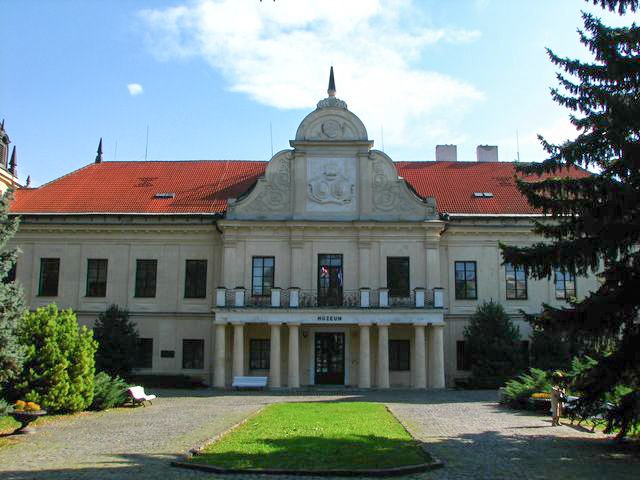
Photo: Mercy, CC BY-SA 3.0.
Trebišov Manor house is a manor estate.

Places in the Area
Nearby places include Trebišov and Vojčice.
Trebišov
Photo: Mercy, CC BY-SA 3.0.
Trebišov is a small industrial town in the easternmost part of Slovakia, with a population of around 25,000. The town is an administrative, economic and cultural center with machine and building materials industries.
Vojčice
Village

Photo: Wikimedia, Public domain.
Vojčice is a village and municipality in the Trebišov District in the Košice Region of south-eastern Slovakia.
Bracovce
Village
Bracovce is a village and municipality in the Michalovce District in the Košice Region of Slovakia.
Sady Trebišov
- Type: Aerodrome
- Category: transportation
- Location: Trebišov, Trebišov District, Košice Region, Slovakia, Central Europe, Europe
- View on OpenStreetMap
Latitude
48.6369° or 48° 38′ 13″ northLongitude
21.7594° or 21° 45′ 34″ eastOpen location code
8GW3JQP5+QQOpenStreetMap ID
node 4504273876OpenStreetMap feature
aeroway=aerodrome
This page is based on OpenStreetMap, Wikidata, and Wikimedia Commons.
We’d love your help improving our open data sources. Thank you for contributing.
Satellite Map
Discover Sady Trebišov from above in high-definition satellite imagery.
Localities in the Area
Explore places such as Člnok and Nový Majer.
Notable Places Nearby
Highlights include Trebišov ŠRT and Hrinište.
Slovakia: Must-Visit Destinations
Delve into Bratislava, Košice, Banská Bystrica, and Trnava.
Curious Aerodromes to Discover
Uncover intriguing aerodromes from every corner of the globe.
About Mapcarta. Data © OpenStreetMap contributors and available under the Open Database License". Text is available under the CC BY-SA 4.0 license, except for photos, directions, and the map. Photo: Danapit, CC BY-SA 3.0.