Settlementet
Settlementet is a charity shop in Vesterbro-Kongens Enghave, Copenhagen municipality, Capital Region. Settlementet is situated nearby to the school Oehlenschlægersgades Skole, as well as near the community center Folkehuset Absalon.| Tap on a place to explore it |
Places of Interest Nearby
Highlights include Gethsemane Church and Enghave Plads.
Gethsemane Church
Church

Photo: Wikimedia, Public domain.
Gethsemane Church is situated 200 metres northeast of Settlementet.
Enghave Plads
Square

Photo: Ramblersen2, CC BY-SA 4.0.
Enghave Plads is a central public square of the Vesterbro district in Copenhagen, Denmark. It is located where Istedgade reaches Enghavevej, which separates the square from Enghave Park. Enghave Plads is situated 340 metres west of Settlementet.
Tivoli Gardens
Theme park
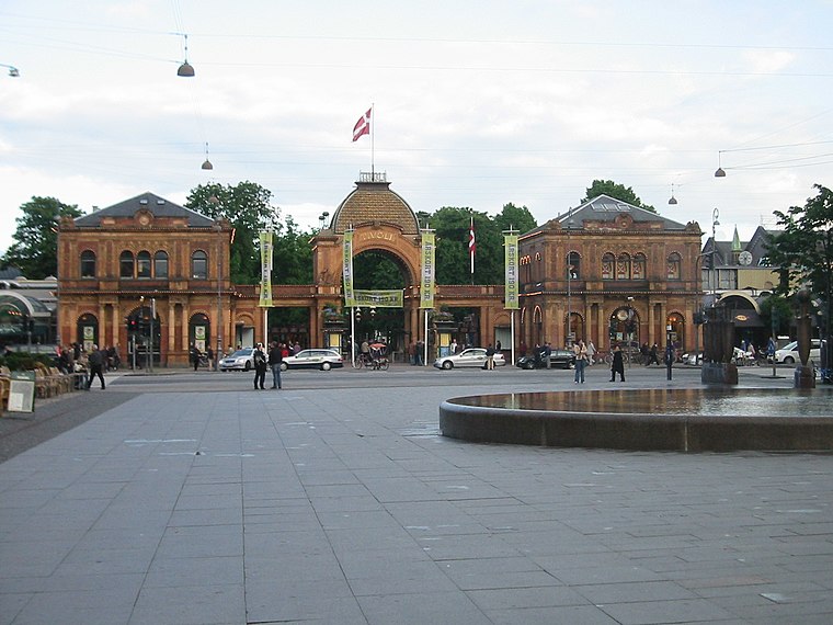
Photo: Elgaard, CC BY-SA 3.0.
Tivoli Gardens, also known simply as Tivoli, is an amusement park and pleasure garden in Copenhagen, Denmark. The park opened on 15 August 1843 and is the second-oldest operating amusement park in the world, after Dyrehavsbakken in nearby Klampenborg, also in Denmark. Tivoli Gardens is situated 1¼ km northeast of Settlementet.
Places in the Area
Nearby places include Vesterbro and Meatpacking District.
Vesterbro

Photo: Dannebrog Spy, CC BY-SA 3.0.
Vesterbro is just outside Copenhagen’s city centre )the Inner City or Indre By), making it a very attractive place to live. It includes the districts of Sydhavnen.
Meatpacking District
Suburb

Photo: Riemann, Public domain.
Kødbyen is a district of Vesterbro in Copenhagen, Denmark. It is situated between the railway lines going into Copenhagen Central Station and Sønder Boulevard.
Humleby
Neighborhood
Humleby is an enclave of terraced houses situated next to the Carlsberg area in the Vesterbro district of Copenhagen, Denmark. They were built between 1885 and 1891 by the Worker's Building Society to provide healthy housing for the workers at Burmeister & Wain.
Settlementet
- Type: Charity shop
- Category: shop
- Location: Vesterbro-Kongens Enghave, Copenhagen municipality, Capital Region, Denmark, Nordic countries, Europe
- View on OpenStreetMap
Latitude
55.66647° or 55° 39′ 59″ northLongitude
12.55122° or 12° 33′ 4″ eastOpen location code
9F7JMH82+HFOpenStreetMap ID
node 4517926584OpenStreetMap feature
shop=charity
This page is based on OpenStreetMap, Wikidata, and Wikimedia Commons.
We’d love your help improving our open data sources. Thank you for contributing.
Satellite Map
Discover Settlementet from above in high-definition satellite imagery.
Notable Places Nearby
Highlights include Oehlenschlægersgades Skole and Folkehuset Absalon.
Nearby Places
Explore places such as Bar Pineau and Tante Olgas Børnehus.
Denmark: Must-Visit Destinations
Delve into Copenhagen, Aarhus, Odense, and Aalborg.
Curious Charity Shops to Discover
Uncover intriguing charity shops from every corner of the globe.
About Mapcarta. Data © OpenStreetMap contributors and available under the Open Database License". Text is available under the CC BY-SA 4.0 license, except for photos, directions, and the map. Photo: Wikimedia, CC BY-SA 3.0.