Helmuth Skive
Helmuth Skive is a café in Skive Municipality, Central Jutland. Helmuth Skive is situated nearby to the square Posthustorvet, as well as near the health club Fit&Sund Skive.| Tap on a place to explore it |
Places of Interest Nearby
Highlights include Skive railway station and Skive Church.
Skive railway station
Railway station
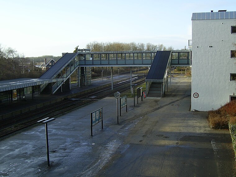
Photo: T-Stone, CC BY-SA 3.0.
Skive station is a railway station serving the town of Skive in Jutland, Denmark. Skive station is located on the Langå-Struer Line from Langå to Struer in the center of the town. Skive railway station is situated 440 metres south of Helmuth Skive.
Skive Church
Church

Photo: Hubertus45, CC BY-SA 3.0.
Skive Church is situated 270 metres west of Helmuth Skive.
Church of Our Lady
Church

Photo: Hubertus45, CC BY-SA 3.0.
Church of Our Lady is situated 270 metres west of Helmuth Skive.
Places in the Area
Nearby places include Skive and Hem.
Skive
Town

Photo: Hubertus45, CC BY-SA 3.0.
Skive is a town in Skive municipality in Region Midtjylland at the base of Salling Peninsula, a part of the larger Jutland peninsula in northwest Denmark.
Hem
Village

Photo: Beethoven9, CC BY-SA 4.0.
Hem is a village, with a population of 583, in Skive Municipality, Central Denmark Region in Denmark. It is situated on the Salling peninsula 14 km south of Roslev, 30 km southeast of Nykøbing Mors and 6 km northwest of Skive. Hem is situated 5 km northwest of Helmuth Skive.
Højslev Stationsby
Village
Højslev Stationsby is a railway town and eastern suburb of the town of Skive, with a population of 2,815, in Skive Municipality, Central Denmark Region in Denmark. Højslev Stationsby is situated 5 km east of Helmuth Skive.
Helmuth Skive
- Opening hours:
11:00 AM—9:00 PM
Friday—Saturday: 11:00 AM—midnight
Sunday: 10:00 AM—9:00 PM - Type: Café
- Location: Skive Municipality, Central Jutland, Denmark, Nordic countries, Europe
- View on OpenStreetMap
Latitude
56.56526° or 56° 33′ 55″ northLongitude
9.02644° or 9° 1′ 35″ eastOpen location code
9F8FH28G+4HOpenStreetMap ID
node 4540476619OpenStreetMap feature
amenity=cafe
This page is based on OpenStreetMap, Wikidata, and Wikimedia Commons.
We’d love your help improving our open data sources. Thank you for contributing.
Satellite Map
Discover Helmuth Skive from above in high-definition satellite imagery.
Notable Places Nearby
Highlights include Posthustorvet and Fit&Sund Skive.
Nearby Places
Explore places such as Skive Løve Apotek and TandproteseTeamet v/Flemming Finøen.
Denmark: Must-Visit Destinations
Delve into Copenhagen, Aarhus, Odense, and Aalborg.
Curious Cafés to Discover
Uncover intriguing cafés from every corner of the globe.
About Mapcarta. Data © OpenStreetMap contributors and available under the Open Database License". Text is available under the CC BY-SA 4.0 license, except for photos, directions, and the map. Photo: Wikimedia, CC BY-SA 3.0.