Fußwegschild
Fußwegschild is in Passau, Lower Bavaria, Bavaria. Fußwegschild is situated nearby to the garden Römischer Nutzgarten, as well as near the playground Römerspielplatz.| Tap on a place to explore it |
Places of Interest Nearby
Highlights include Severinstor and St. Stephen’s Cathedral.
Severinstor
City gate

Photo: Wikimedia, CC BY-SA 2.5.
Severinstor is a city gate, which is situated 140 metres west of Fußwegschild.
St. Stephen’s Cathedral
Church
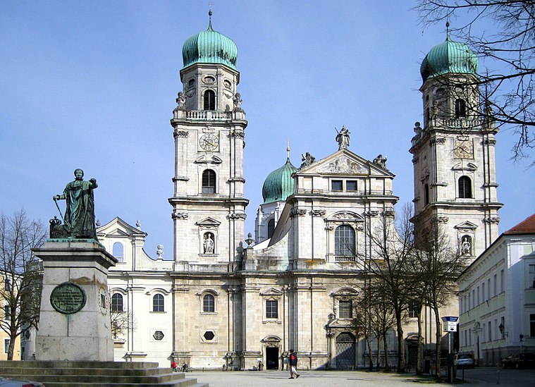
Photo: Aconcagua, CC BY-SA 3.0.
St. Stephen's Cathedral is a baroque church from 1688 in Passau, Germany, dedicated to Saint Stephen. It is the seat of the Catholic Bishop of Passau and the main church of his diocese. St. Stephen’s Cathedral is situated 550 metres north of Fußwegschild.
St. Severin, Passau
Church

Photo: Aconcagua, CC BY-SA 3.0.
St. Severin, Passau is a church, which is situated 240 metres west of Fußwegschild.
Places in the Area
Nearby places include Altstadt (Passau) and Hacklberg.


Hals
Suburb

Photo: Aconcagua, CC BY-SA 3.0.
Hals is a quarter in the northern part of Passau, whose geography is strongly influenced by the river Ilz.
Fußwegschild
- Type: Sign
- Categories: information and tourism
- Location: Passau, Lower Bavaria, Bavaria, Germany, Central Europe, Europe
- View on OpenStreetMap
Latitude
48.56954° or 48° 34′ 10″ northLongitude
13.46348° or 13° 27′ 49″ eastOpen location code
8FWMHF97+R9OpenStreetMap ID
node 4541675571OpenStreetMap feature
tourism=information
This page is based on OpenStreetMap, Wikidata, and Wikimedia Commons.
We’d love your help improving our open data sources. Thank you for contributing.
Satellite Map
Discover Fußwegschild from above in high-definition satellite imagery.
Notable Places Nearby
Highlights include Römischer Nutzgarten and Römerspielplatz.
Nearby Places
Explore places such as Römer Museum - Öffnungszeiten and Römer Museum.
Lower Bavaria: Must-Visit Destinations
Delve into Landshut, Straubing, Deggendorf, and Kelheim.
Curious Places to Discover
Uncover intriguing places from every corner of the globe.
About Mapcarta. Data © OpenStreetMap contributors and available under the Open Database License". Text is available under the CC BY-SA 4.0 license, except for photos, directions, and the map. Photo: Traveler100, CC BY-SA 3.0.