Kiawaithanji Primary School
Kiawaithanji Primary School is a school in Nyeri County, Kenya.| Tap on a place to explore it |
Places in the Area
Nearby places include Marua and Nyeri.
Marua
Village
The Central Province was a region in central Kenya until 2013, when Kenya's provinces were replaced by a system of counties. It covered an area of 11,449 km2 and was located to the north of Nairobi and west of Mount Kenya. Marua is situated 7 km northeast of Kiawaithanji Primary School.
Nyeri
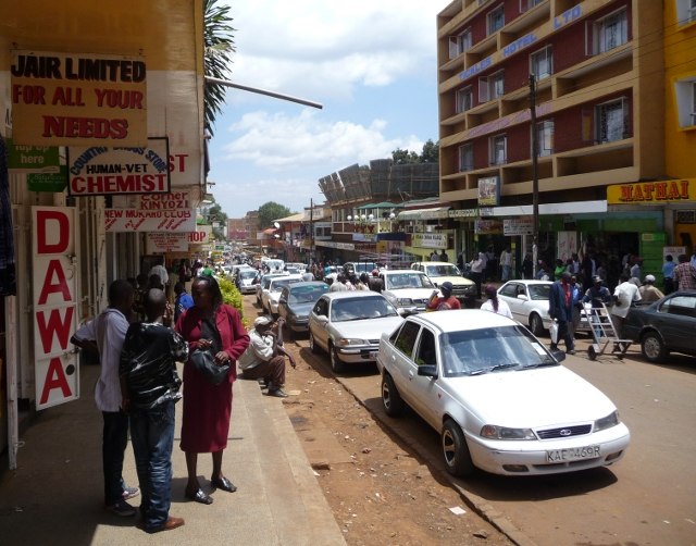
Photo: Rotsee2, CC BY-SA 3.0.
Nyeri is a town situated in the Central Highlands of Kenya. It is the county headquarters of Nyeri County and was the central administrative headquarters of the country's former Central Province.
Othaya
Village
Othaya is a Kenyan town about 120 kilometres north of Nairobi, the capital. It had a population of 21,427, of which 4,108 are core urban; the majority of the residents are of the Kikuyu tribe. Othaya is situated 9 km southwest of Kiawaithanji Primary School.
Kiawaithanji Primary School
- Type: School
- Category: education
- Location: Nyeri County, Kenya, East Africa, Africa
- View on OpenStreetMap
Latitude
-0.48288° or 0° 28′ 58″ southLongitude
36.98395° or 36° 59′ 2″ eastOpen location code
6GFRGX8M+RHOpenStreetMap ID
node 4576608748OpenStreetMap feature
amenity=school
This page is based on OpenStreetMap, Wikidata, and Wikimedia Commons.
We’d love your help improving our open data sources. Thank you for contributing.
Satellite Map
Discover Kiawaithanji Primary School from above in high-definition satellite imagery.
Notable Places Nearby
Highlights include Kagumo Teachers Training College and Kingdom Hall of Jehovas Witnesses.
Nearby Places
Explore places such as Mirichu Primary School, Kenya and Mutathi-Ini Primary Schoo.
Kenya: Must-Visit Destinations
Delve into Nairobi, Mombasa, Mount Kenya, and Lake Turkana.
Curious Schools to Discover
Uncover intriguing schools from every corner of the globe.
About Mapcarta. Data © OpenStreetMap contributors and available under the Open Database License". Text is available under the CC BY-SA 4.0 license, except for photos, directions, and the map. Photo: Wikimedia, CC0.