Fussweg Spital
Fussweg Spital is a bus stop in Unterseen, Interlaken-Oberhasli, Canton of Bern. Fussweg Spital is situated nearby to the power station Wehranlage und Dotierkraftwerk «Gurben», as well as near the playground Spielplatz Schulanlage Steindler.| Tap on a place to explore it |
Places of Interest Nearby
Highlights include Interlaken West railway station and Villa Cranz.
Interlaken West railway station
Railway station

Photo: Belteshassar, CC BY-SA 3.0.
Interlaken West is a railway station in the resort town of Interlaken, in the Swiss canton of Bern. It is on the Thunersee line of the BLS AG, and is one of two stations in the town, the other being Interlaken Ost. Interlaken West railway station is situated 1 km east of Fussweg Spital.
Villa Cranz
Government office

Photo: 1rhb, CC BY-SA 4.0.
Villa Cranz is a government office, which is situated 1 km east of Fussweg Spital.
Power station on the Interlaken canal
Power station

Photo: Lantus, CC BY-SA 3.0.
Power station on the Interlaken canal is situated 700 metres east of Fussweg Spital.
Places in the Area
Nearby places include Interlaken and Harderkulm.
Interlaken
 Interlaken is a small city in the Bernese Highlands region of central Switzerland. Located between two alpine lakes, Interlaken is a popular base camp for outdoor sports and travel in the surrounding Bernese Oberland Alps.
Harderkulm
Locality

Photo: Pemm, Public domain.
The Harderkulm is a funicular station at 1,322 metres in the Berner Oberland region of Switzerland, overlooking the towns of Interlaken and Unterseen. It is located at the western end of the Harder, which in itself is the most western, forested ridge of the about 30 kilometres long, prominent mountain range dominating the north shore of the Lake of Brienz.
Matten bei Interlaken
Village
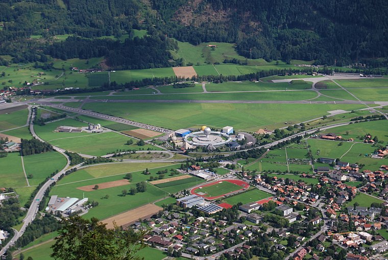
Photo: DidiWeidmann, CC BY-SA 3.0.
Matten bei Interlaken is a village and municipality in the Interlaken-Oberhasli administrative district in the canton of Bern in Switzerland. Matten b.I. belongs to the Small Agglomeration Interlaken with 23,300 inhabitants.
Fussweg Spital
- Type: Bus stop
- Categories: transport stop and transportation
- Location: Unterseen, Interlaken-Oberhasli, Canton of Bern, Switzerland, Central Europe, Europe
- View on OpenStreetMap
Latitude
46.68188° or 46° 40′ 55″ northLongitude
7.84107° or 7° 50′ 28″ eastElevation
572 metres (1,877 feet)Operator
STINetwork
Ortsbus InterlakenOpen location code
8FR9MRJR+QCOpenStreetMap ID
node 4577110788OpenStreetMap feature
public_transport=stop_position
This page is based on OpenStreetMap, Wikidata, and Wikimedia Commons.
We’d love your help improving our open data sources. Thank you for contributing.
Satellite Map
Discover Fussweg Spital from above in high-definition satellite imagery.
Notable Places Nearby
Highlights include Wehranlage und Dotierkraftwerk «Gurben» and Spielplatz Schulanlage Steindler.
Nearby Places
Explore places such as Unterseen, Fussweg Spital and Fussweg Spital.
Switzerland: Must-Visit Destinations
Delve into Zurich, Berne, Geneva, and Basel.
Curious Bus Stops to Discover
Uncover intriguing bus stops from every corner of the globe.
About Mapcarta. Data © OpenStreetMap contributors and available under the Open Database License". Text is available under the CC BY-SA 4.0 license, except for photos, directions, and the map. Photo: Simonizer, CC BY-SA 2.0 de.