College Park
College Park is a park in Charleston County, South Carolina. College Park is situated nearby to Westminster Presbyterian Church, as well as near Parkside Church.| Tap on a place to explore it |
Places of Interest Nearby
Highlights include Hampton Park and Allan Park.
Hampton Park
Park

Photo: ProfReader, Public domain.
Hampton Park is a public park located in peninsular Charleston, South Carolina, United States. At 60 acres, it is the largest park on the peninsula. It is bordered by The Citadel to the west, Hampton Park Terrace to the south, North Central to the east, and Wagener Terrace to the north.
Allan Park
Park
Allan Park is a park in Charleston, South Carolina. The parcel of land was donated to the City of Charleston by Amey Allan, the widow of James Allan and the developer of most of the eastern half of Hampton Park Terrace parks on the peninsula, on March 23, 1920. Allan Park is situated 1,400 feet south of College Park.
The Citadel
University
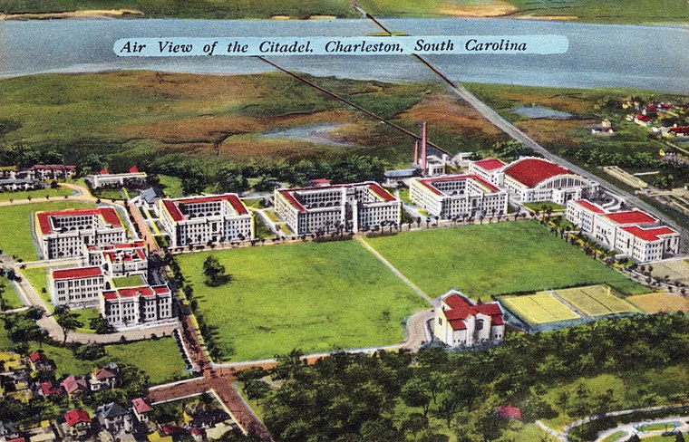
Photo: Wikimedia, Public domain.
The Citadel Military College of South Carolina is a public senior military college in Charleston, South Carolina, United States. Established in 1842, it is the third oldest of the six senior military colleges in the United States. The Citadel is situated 2,700 feet southwest of College Park.
Places in the Area
Nearby places include Hampton Park Terrace and Hampstead Village.
Hampton Park Terrace
Neighborhood

Photo: ProfReader, CC BY-SA 3.0.
Hampton Park Terrace is the name both of a neighborhood and a National Register district located in peninsular Charleston, South Carolina. The neighborhood is bounded on the west by The Citadel, on the north by Hampton Park, on the east by Rutledge Ave, and on the south by Congress St.
Hampstead Village
Quarter
Hampstead Village is a neighborhood in Charleston, South Carolina in the US, also known as the Eastside or the East Side. A prominent merchant, Henry Laurens, bought several tracts totaling 99 acres where Hampstead Village is today.
Charleston
 Charleston is the largest and oldest city in the state of South Carolina in the United States of America. Its historic downtown is on a peninsula formed by two rivers, the Ashley and the Cooper, flowing into the Atlantic, and protected from the open ocean by surrounding islands.
College Park
- Type: Park
- Category: recreation area
- Location: Charleston County, South Carolina, South, United States, North America
- View on OpenStreetMap
Latitude
32.80113° or 32° 48′ 4″ northLongitude
-79.9533° or 79° 57′ 12″ westOpen location code
8742R22W+FMOpenStreetMap ID
node 457728851OpenStreetMap feature
leisure=park
This page is based on OpenStreetMap, Wikidata, and Wikimedia Commons.
We’d love your help improving our open data sources. Thank you for contributing.
Satellite Map
Discover College Park from above in high-definition satellite imagery.
Places with the Same Name
Discover other places named “College Park”.
Notable Places Nearby
Highlights include Westminster Presbyterian Church and Parkside Church.
Nearby Places
Explore places such as Moe’s Crosstown Tavern and Gazebo.
South Carolina: Must-Visit Destinations
Delve into Columbia, Charleston, Greenville, and Myrtle Beach.
Curious Parks to Discover
Uncover intriguing parks from every corner of the globe.
About Mapcarta. Data © OpenStreetMap contributors and available under the Open Database License". Text is available under the CC BY-SA 4.0 license, except for photos, directions, and the map. Photo: Rastapopulous, CC BY-SA 3.0.