Zipcar
Zipcar is in City of Boston, Suffolk, Massachusetts. Zipcar is situated nearby to First Church, Charlestown, as well as near the park Thompson Square.| Tap on a place to explore it |
Places of Interest Nearby
Highlights include Bunker Hill Monument and USS Constitution.
Bunker Hill Monument
Scenic viewpoint
The Bunker Hill Monument is a monument erected at the site of the Battle of Bunker Hill in Boston, Massachusetts, which was among the first major battles between the United Colonies and the British Empire in the American Revolutionary War. Bunker Hill Monument is situated 720 feet east of Zipcar.
USS Constitution
Museum

Photo: Wikimedia, Public domain.
USS Constitution, also known as Old Ironsides, is a three-masted wooden-hulled heavy frigate of the United States Navy. She is the world's oldest commissioned warship still afloat. USS Constitution is situated 2,200 feet southeast of Zipcar.
TD Garden
Stadium
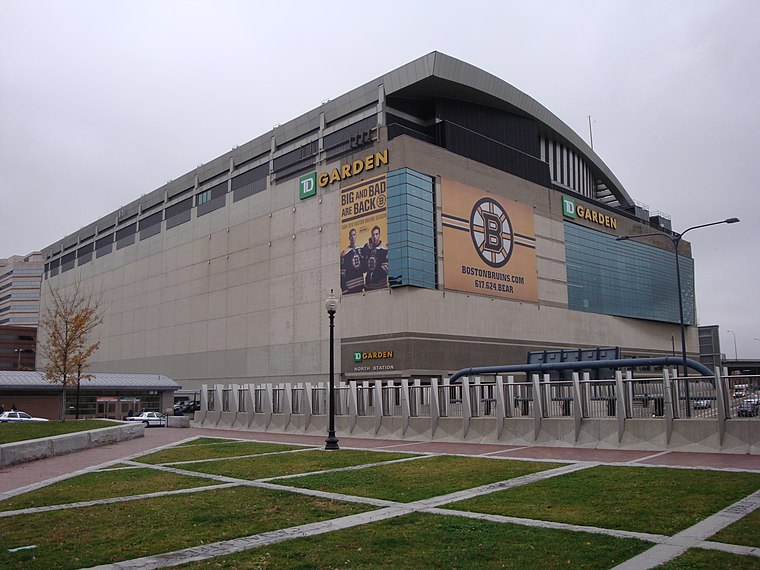
Photo: Nywalton, Public domain.
TD Garden is a multi-purpose arena in Boston. It is located directly above the MBTA's North Station, and it replaced the original Boston Garden upon opening in 1995. TD Garden is situated 3,500 feet south of Zipcar.
Places in the Area
Nearby places include Charlestown and Sullivan Square.
Charlestown

Photo: Traveler100, CC BY-SA 3.0.
Boston's Charlestown was the traditional home of employees at the now-decommissioned Navy Yard. It has experienced a shift in its population and industry and an increasing number of young professionals are joining the families who have lived in the area for years.
Sullivan Square
Locality
Sullivan Square is a traffic circle located at the north end of the Charlestown neighborhood of Boston, Massachusetts. It is named after James Sullivan, an early 19th-century Governor of Massachusetts.
West End
Suburb

Photo: RawheaD Rex, CC BY-SA 2.0.
The West End is a neighborhood of Boston, Massachusetts, United States, bounded generally by Cambridge Street to the south, the Charles River to the west and northwest, North Washington Street on the north and northeast, and New Sudbury Street on the east.
Zipcar
- Type: Carsharing
- Category: transportation
- Location: City of Boston, Suffolk, Massachusetts, New England, United States, North America
- View on OpenStreetMap
Latitude
42.37576° or 42° 22′ 33″ northLongitude
-71.06333° or 71° 3′ 48″ westOperator
ZipcarOpen location code
87JC9WGP+8MOpenStreetMap ID
node 4617104088OpenStreetMap feature
amenity=car_sharing
This page is based on OpenStreetMap, Wikidata, and Wikimedia Commons.
We’d love your help improving our open data sources. Thank you for contributing.
Satellite Map
Discover Zipcar from above in high-definition satellite imagery.
Places with the Same Name
Discover other places named “Zipcar”.
Notable Places Nearby
Highlights include First Church, Charlestown and Thompson Square.
Nearby Places
Explore places such as Warren St @ Church St and Charlestown Liquor Store.
Massachusetts: Must-Visit Destinations
Delve into Boston, Cambridge, Springfield, and Worcester.
Curious Places to Discover
Uncover intriguing places from every corner of the globe.
About Mapcarta. Data © OpenStreetMap contributors and available under the Open Database License". Text is available under the CC BY-SA 4.0 license, except for photos, directions, and the map. Photo: papadunes, CC BY-SA 3.0.