Ying Yang Tattoo
Ying Yang Tattoo is a tattoo parlor in Berlin, Berlin. Ying Yang Tattoo is situated nearby to the square Attilaplatz, as well as near the park Alarichplatz.| Tap on a place to explore it |
Places of Interest Nearby
Highlights include Herz-Jesu-Kirche and Hochbunker Friedrich-Karl-Straße.
Herz-Jesu-Kirche
Church

Photo: Sekamor, CC BY-SA 3.0.
Herz-Jesu-Kirche is a church, which is situated 420 metres northeast of Ying Yang Tattoo.
Hochbunker Friedrich-Karl-Straße
Bunker

Photo: Sekamor, CC BY-SA 3.0.
Hochbunker Friedrich-Karl-Straße is situated 270 metres northeast of Ying Yang Tattoo.
Tempelhofer Hafen
Shopping center
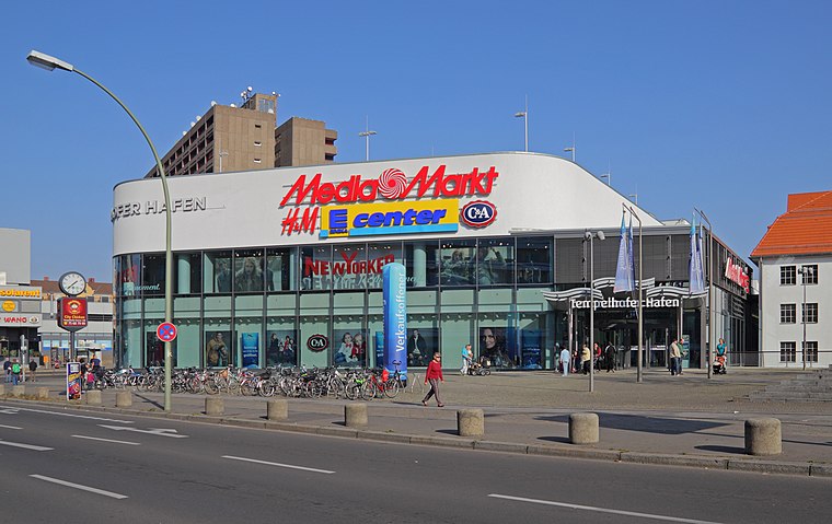
Photo: A.Savin, CC BY-SA 3.0.
Tempelhofer Hafen is a shopping center, which is situated 680 metres east of Ying Yang Tattoo.
Places in the Area
Nearby places include Rote Insel and Tempelhof and Neukölln.
Rote Insel
Quarter
Rote Insel is the name colloquially given to a neighborhood in the Schöneberg district of the German capital, Berlin. As such, the neighborhood is part of Berlin's 7th administrative borough, Tempelhof-Schöneberg. Rote Insel is situated 3 km north of Ying Yang Tattoo.
Tempelhof and Neukölln

Photo: Brücke-Osteuropa, CC0.
Tempelhof and Neukölln are two districts in the central south of Berlin.
Viktoria-Quartier
Neighborhood

Photo: Wikimedia, CC BY-SA 3.0 de.
Viktoria-Quartier is a neighborhood, which is situated 3½ km north of Ying Yang Tattoo.
Ying Yang Tattoo
- Type: Tattoo parlor
- Wheelchair access: no
- Category: shop
- Location: Berlin, Berlin, Stadt, Berlin, Germany, Central Europe, Europe
- View on OpenStreetMap
Latitude
52.45539° or 52° 27′ 19″ northLongitude
13.37601° or 13° 22′ 34″ eastOpen location code
9F4MF94G+5COpenStreetMap ID
node 471134937OpenStreetMap feature
shop=tattooOpenStreetMap attribute
wheelchair=no
This page is based on OpenStreetMap, Wikidata, and Wikimedia Commons.
We’d love your help improving our open data sources. Thank you for contributing.
Satellite Map
Discover Ying Yang Tattoo from above in high-definition satellite imagery.
Notable Places Nearby
Highlights include Attilaplatz and Alarichplatz.
Nearby Places
Explore places such as Attila Reinigung and Kindertagespflege - ‘Klitzeklein’.
Berlin: Must-Visit Destinations
Delve into Mitte, East Central, City West, and East Berlin.
Curious Tattoo Parlors to Discover
Uncover intriguing tattoo parlors from every corner of the globe.
About Mapcarta. Data © OpenStreetMap contributors and available under the Open Database License". Text is available under the CC BY-SA 4.0 license, except for photos, directions, and the map. Photo: Berthold Werner, CC BY-SA 3.0.