Kurzzeit 15 min
Kurzzeit 15 min is a parking area in Männedorf, Meilen District, Canton of Zurich. Kurzzeit 15 min is situated nearby to Mittelwiesplatz, as well as near Leueplatz.| Tap on a place to explore it |
Places of Interest Nearby
Highlights include Männedorf railway station and Spital Männedorf.
Männedorf railway station
Railway station
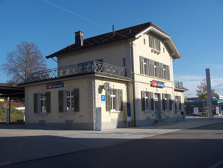
Photo: Blademaster88, CC BY-SA 3.0.
Männedorf is a railway station in the Swiss canton of Zurich, situated in the municipality of Männedorf on the eastern shore of Lake Zurich. The station is located on the Lake Zurich right bank railway line, within fare zone 142 of the Zürcher Verkehrsverbund. Männedorf railway station is situated 150 metres northwest of Kurzzeit 15 min.
Spital Männedorf
Hospital

Photo: Roland zh, CC BY-SA 3.0.
Spital Männedorf is a hospital, which is situated 210 metres southeast of Kurzzeit 15 min.
Pfarrkirche St. Stephan
Church

Photo: Paebi, CC BY-SA 3.0.
Pfarrkirche St. Stephan is a church, which is situated 270 metres northeast of Kurzzeit 15 min.
Places in the Area
Nearby places include Mutzmalen and Uetikon am See.
Mutzmalen
Hamlet
Photo: Parpan05, CC BY-SA 3.0.
Mutzmalen is a small village between Stäfa and Männedorf, in the canton of Zürich in Switzerland.
Uetikon am See
Village

Photo: Iotatau, CC BY-SA 3.0.
Uetikon am See is a municipality in the district of Meilen in the canton of Zürich in Switzerland.
Oetwil am See
Village

Photo: Waldteufel78, CC BY-SA 4.0.
Oetwil am See is a municipality in the district of Meilen in the canton of Zürich in Switzerland. It is located in the Pfannenstiel region. Oetwil am See is situated 3 km northeast of Kurzzeit 15 min.
Kurzzeit 15 min
- Type: Parking area
- Parking: lane
- Category: transportation
- Location: Männedorf, Meilen District, Canton of Zurich, Switzerland, Central Europe, Europe
- View on OpenStreetMap
Latitude
47.25245° or 47° 15′ 9″ northLongitude
8.6944° or 8° 41′ 40″ eastOpen location code
8FVC7M2V+XQOpenStreetMap ID
node 475515626OpenStreetMap feature
amenity=parkingOpenStreetMap attribute
parking=lane
This page is based on OpenStreetMap, Wikidata, and Wikimedia Commons.
We’d love your help improving our open data sources. Thank you for contributing.
Satellite Map
Discover Kurzzeit 15 min from above in high-definition satellite imagery.
Notable Places Nearby
Highlights include Mittelwiesplatz and Gemeindesaal.
Nearby Places
Explore places such as Männedorf Bahnhof and Villa Monneron.
Switzerland: Must-Visit Destinations
Delve into Zurich, Berne, Geneva, and Basel.
Curious Parking Areas to Discover
Uncover intriguing parking areas from every corner of the globe.
About Mapcarta. Data © OpenStreetMap contributors and available under the Open Database License". Text is available under the CC BY-SA 4.0 license, except for photos, directions, and the map. Photo: Roland zh, CC BY-SA 3.0.