North Africa Bank-Mitiqa
North Africa Bank-Mitiqa is a bank in Tripoli, Libya which is located on مطار معيتيقة. North Africa Bank-Mitiqa is situated nearby to the government office مكتب جوازات المطار, as well as near MITIGA Hospital.| Tap on a place to explore it |
- Opening hours: Sunday—Thursday 9:00 AM—2:00 PM
- Type: Bank
- Address: مطار معيتيقة
Places of Interest Nearby
Highlights include Mitiga International Airport.
Mitiga International Airport
Aerodrome
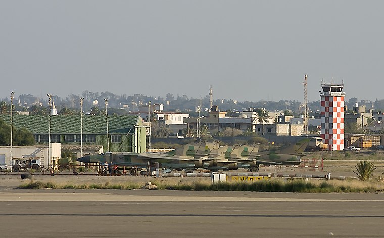
Photo: Rob Schleiffert, CC BY-SA 2.0.
Mitiga International Airport is an airport that serves Tripoli, Libya, located about 8 kilometres east of Tripoli's city centre. Since 2018 it has been the sole international airport serving Tripoli following the closure of Tripoli International Airport after it was severely damaged in the second Libyan civil war.
Places in the Area
Nearby places include Tajura and Tripoli.
Tajura
Town
 Tajura, also spelt Tajoura, is a town in north-western Libya, and baladiyah in the Tripoli Muhafazah, on the Mediterranean coast 23 kilometres east of Tripoli. Tajura is situated 8 km east of North Africa Bank-Mitiqa.
Tripoli

Photo: Jaw101ie, CC BY-SA 3.0.
Tripoli is the capital, largest city, principal harbour and biggest commercial and manufacturing centre of the North African country of Libya. Tripoli is in the north-west of Libya on the Mediterranean Sea. It is home to about 1.3 million people…
North Africa Bank-Mitiqa
- Location: Tripoli, Libya, North Africa, Africa
- View on OpenStreetMap
Latitude
32.90553° or 32° 54′ 20″ northLongitude
13.27374° or 13° 16′ 26″ eastOpen location code
8F4MW74F+6FOpenStreetMap ID
node 4764406621OpenStreetMap feature
amenity=bank
This page is based on OpenStreetMap, Wikidata, and Wikimedia Commons.
We’d love your help improving our open data sources. Thank you for contributing.
Satellite Map
Discover North Africa Bank-Mitiqa from above in high-definition satellite imagery.
In Other Languages
“North Africa Bank-Mitiqa” goes by many names.
- Arabic: “مصرف شمال افريقيا وكالة معيتيقة”
Notable Places Nearby
Highlights include مكتب جوازات المطار and MITIGA Hospital.
Nearby Places
Explore places such as TunisAir and Libyan Wings Fly.
Libya: Must-Visit Destinations
Delve into Tripoli, Benghazi, Bayda, and Surt.
Curious Banks to Discover
Uncover intriguing banks from every corner of the globe.
About Mapcarta. Data © OpenStreetMap contributors and available under the Open Database License". Text is available under the CC BY-SA 4.0 license, except for photos, directions, and the map. Photo: Wikimedia, CC0.