Himmelpforten, Steinkamp
Himmelpforten, Steinkamp is a transport stop in Himmelpforten, Stade, Lower Saxony. Himmelpforten, Steinkamp is situated nearby to the community center Villa von Issendorff, as well as near Eulsete-Halle.| Tap on a place to explore it |
Places of Interest Nearby
Highlights include St. Mary’s Church and Wehbers Mühle.
St. Mary’s Church
Church
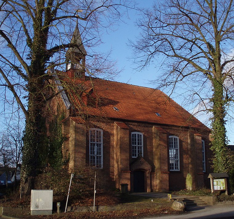
Photo: Morn the Gorn, CC BY-SA 3.0.
The Saint Mary's Church is a Lutheran parish church used and owned by the Lutheran parish in Himmelpforten, Lower Saxony, Germany. The Himmelpforten parish forms part of the Stade deanery within the Stade diocese of the Lutheran Church of Hanover. St. Mary’s Church is situated 690 metres north of Himmelpforten, Steinkamp.
Wehbers Mühle
Windmill
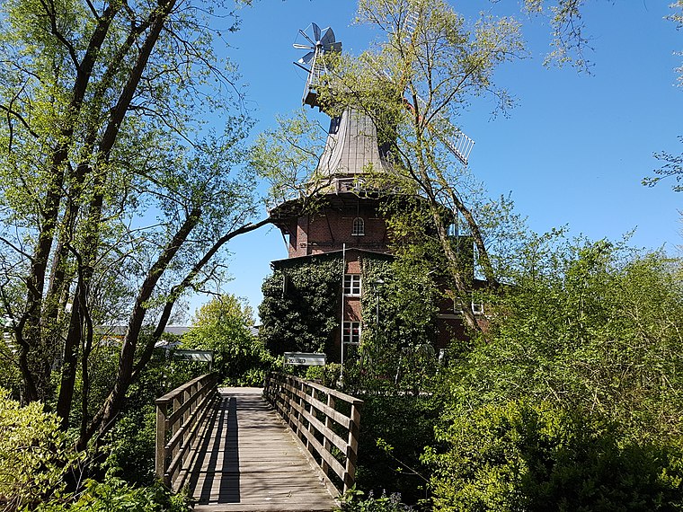
Photo: Tessa206, CC BY-SA 4.0.
Wehbers Mühle is a windmill, which is situated 1 km north of Himmelpforten, Steinkamp.
Himmelpforten station
Railway stop

Photo: Raboe001, CC BY-SA 3.0.
Himmelpforten station is a railway stop, which is situated 1½ km north of Himmelpforten, Steinkamp.
Places in the Area
Nearby places include Kuhla and Burweg.

Burweg
Village

Photo: Tadü, CC BY-SA 4.0.
Burweg is a municipality in the district of Stade, Lower Saxony, Germany. Burweg is situated 3 km northwest of Himmelpforten, Steinkamp.
Düdenbüttel
Village

Photo: Christian der Vierte, CC BY-SA 4.0.
Düdenbüttel is a municipality in the district of Stade, Lower Saxony, Germany. Düdenbüttel is situated 3½ km southeast of Himmelpforten, Steinkamp.
Himmelpforten, Steinkamp
- Type: Transport stop
- Categories: bus stop and transportation
- Location: Himmelpforten, Stade, Lower Saxony, Germany, Central Europe, Europe
- View on OpenStreetMap
Latitude
53.60827° or 53° 36′ 30″ northLongitude
9.305° or 9° 18′ 18″ eastOperator
BürgerBus Osteland e.V.Open location code
9F5FJ854+82OpenStreetMap ID
node 4805302890OpenStreetMap feature
highway=bus_stopOpenStreetMap feature
public_transport=stop_position
This page is based on OpenStreetMap, Wikidata, and Wikimedia Commons.
We’d love your help improving our open data sources. Thank you for contributing.
Satellite Map
Discover Himmelpforten, Steinkamp from above in high-definition satellite imagery.
Notable Places Nearby
Highlights include Villa von Issendorff and Eulsete-Halle.
Nearby Places
Explore places such as Himmelpforten, Brink 28 and Bäckerei Lünstedt.
Lower Saxony: Must-Visit Destinations
Delve into Hanover, Göttingen, Brunswick, and Wolfsburg.
Curious Transport Stops to Discover
Uncover intriguing transport stops from every corner of the globe.
About Mapcarta. Data © OpenStreetMap contributors and available under the Open Database License". Text is available under the CC BY-SA 4.0 license, except for photos, directions, and the map. Photo: Danapit, CC BY-SA 3.0.