Pogorzelica Sandra
Pogorzelica Sandra is a railway stop in Zachodniopomorskie, Poland. Pogorzelica Sandra is situated nearby to the sports venue Wspinaczka, as well as near the outdoor gym Workout.| Tap on a place to explore it |
Places of Interest Nearby
Highlights include Liwia Łuża Lake and Museum of Sea Fishery.

Museum of Sea Fishery
Museum
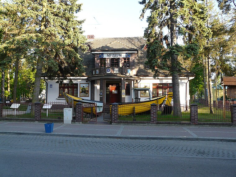
Photo: Piotrus, CC BY-SA 3.0.
Museum of Sea Fishery is situated 1 km west of Pogorzelica Sandra.
Niechorze Lighthouse

Photo: Aw58, CC BY-SA 3.0 pl.
Niechorze Lighthouse is a lighthouse in Niechorze, on the Polish coast of the Baltic Sea, by a steep cliff. The lighthouse is located in Niechorze, West Pomeranian Voivodeship, in Poland. Niechorze Lighthouse is situated 2½ km west of Pogorzelica Sandra.
Places in the Area
Nearby places include Niechorze and Skalno.
Niechorze
Village

Photo: Mateusz War., CC BY-SA 3.0.
Niechorze is a village in the administrative district of Gmina Rewal, within Gryfice County, West Pomeranian Voivodeship, in north-western Poland. It is situated between the Baltic Sea to the north and Liwia Łuża lake to the south.
Skalno
Hamlet

Photo: Kenraiz, CC BY-SA 4.0.
Skalno is a village in the administrative district of Gmina Karnice, within Gryfice County, West Pomeranian Voivodeship, in north-western Poland. It lies approximately 7 km north-east of Karnice, 20 km north of Gryfice, and 82 km north-east of the regional capital Szczecin.
Pogorzelica
Village
Photo: Lzur, CC BY-SA 3.0.
Pogorzelica is a village in the administrative district of Gmina Rewal, within Gryfice County, West Pomeranian Voivodeship, in northwestern Poland. It lies approximately 7 km east of Rewal, 22 km north of Gryfice, and 84 km northeast of the regional capital Szczecin.
Pogorzelica Sandra
- Type: Railway stop
- Categories: transport stop and transportation
- Location: Zachodniopomorskie, Poland, Central Europe, Europe
- View on OpenStreetMap
Latitude
54.09396° or 54° 5′ 38″ northLongitude
15.10144° or 15° 6′ 5″ eastOpen location code
9F6Q34V2+HHOpenStreetMap ID
node 4842038150OpenStreetMap feature
public_transport=haltOpenStreetMap feature
railway=halt
This page is based on OpenStreetMap, Wikidata, and Wikimedia Commons.
We’d love your help improving our open data sources. Thank you for contributing.
Satellite Map
Discover Pogorzelica Sandra from above in high-definition satellite imagery.
Notable Places Nearby
Highlights include Wspinaczka and Workout.
Nearby Places
Explore places such as Baza Obozowa Chorągwi Zachodniopomorskiej and 60.
Zachodniopomorskie: Must-Visit Destinations
Delve into Szczecin, Świnoujście, Koszalin, and Kołobrzeg.
Curious Railway Stops to Discover
Uncover intriguing railway stops from every corner of the globe.
About Mapcarta. Data © OpenStreetMap contributors and available under the Open Database License". Text is available under the CC BY-SA 4.0 license, except for photos, directions, and the map. Photo: Sicherlich, CC BY 3.0.