Rettungswache Walsrode
Rettungswache Walsrode is an ambulance station in Walsrode, Heidekreis, Lower Saxony which is located on Albrecht-Thaer-Straße. Rettungswache Walsrode is situated nearby to the railway station Vorwalsrode, as well as near the meadow Gänseweide.| Tap on a place to explore it |
Places of Interest Nearby
Highlights include Jewish Cemetery and Stadtkirche.
Jewish Cemetery
Cemetery

Photo: AxelHH, Public domain.
Jewish Cemetery is situated 570 metres north of Rettungswache Walsrode.
Stadtkirche
Church
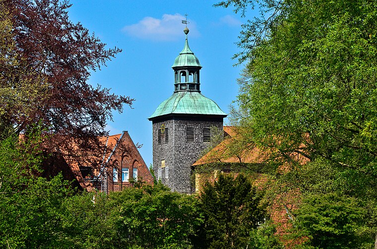
Photo: Fiorellino, CC BY-SA 3.0.
Stadtkirche is a church, which is situated 1 km north of Rettungswache Walsrode.
Walsrode Abbey
Monastery

Photo: Ulamm, CC BY-SA 4.0.
Walsrode Abbey in Walsrode, Germany, is one of the historic monasteries of Benedictine nuns on the Lüneburg Heath in North Germany which are collectively known as the Lüneklöster. Walsrode Abbey is situated 1 km north of Rettungswache Walsrode.
Places in the Area
Nearby places include Benzen and Düshorn.
Benzen
Village
Benzen is a village and Ortschaft in the town of Walsrode in the Heidekreis district, Lower Saxony, north Germany.
Düshorn
Village

Photo: Losch, CC BY-SA 3.0.
Düshorn is a village, which is situated 3 km southeast of Rettungswache Walsrode.
Borg
Village

Photo: Fiorellino, CC BY-SA 3.0.
Borg is a village, which is situated 5 km north of Rettungswache Walsrode.
Rettungswache Walsrode
- Type: Ambulance station
- Address: Albrecht-Thaer-Straße 2, Walsrode, 29664
- Category: health care
- Location: Walsrode, Heidekreis, Lüneburg Heath, Lower Saxony, Germany, Central Europe, Europe
- View on OpenStreetMap
Latitude
52.85118° or 52° 51′ 4″ northLongitude
9.59691° or 9° 35′ 49″ eastBrand
German Red CrossOperator
Deutsches Rotes Kreuz Kreisverband Fallingbostel e.V.Open location code
9F4FVH2W+FQOpenStreetMap ID
node 4879436767
This page is based on OpenStreetMap, Wikidata, and Wikimedia Commons.
We’d love your help improving our open data sources. Thank you for contributing.
Satellite Map
Discover Rettungswache Walsrode from above in high-definition satellite imagery.
Notable Places Nearby
Highlights include Vorwalsrode and Schützenverein Vorwalsrode von 1906 e.V..
Nearby Places
Explore places such as DRK-Kreisverband Fallingbostel and Pestalozzi-Schule Walsrode.
Lüneburg Heath: Must-Visit Destinations
Delve into Lüneburg, Celle, Gifhorn, and Soltau.
Curious Ambulance Stations to Discover
Uncover intriguing ambulance stations from every corner of the globe.
About Mapcarta. Data © OpenStreetMap contributors and available under the Open Database License". Text is available under the CC BY-SA 4.0 license, except for photos, directions, and the map. Photo: Fiorellino, CC BY-SA 3.0.