St-Maurice (Arsenal)
St-Maurice (Arsenal) is an aerial lift in Saint-Maurice, Valais. St-Maurice (Arsenal) is situated nearby to RSV Centre Hospitalier du Chablais, Clinique Saint-Amé, as well as near the castle Fort du Scex.| Tap on a place to explore it |
Places of Interest Nearby
Highlights include Fort du Scex and St-Maurice railway station.
Fort du Scex
Castle
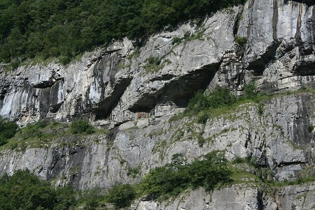
Photo: Wikimedia, CC BY-SA 3.0.
The Fort du Scex is a component of Fortress Saint-Maurice, which is in turn one of the three principal fortified regions of the National Redoubt of Switzerland. Fort du Scex is situated 180 metres west of St-Maurice (Arsenal).
St-Maurice railway station
Railway station
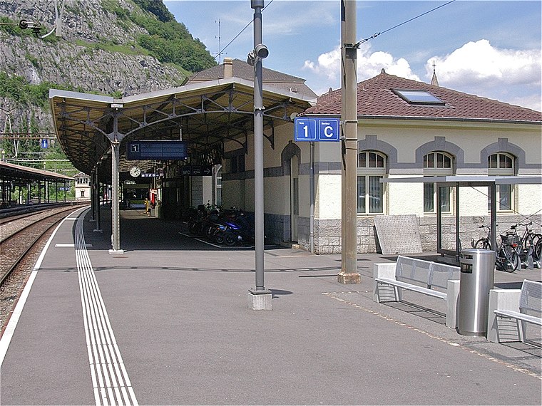
Photo: Albins, CC BY-SA 3.0.
St-Maurice railway station is a railway station in the municipality of Saint-Maurice, in the Swiss canton of Valais. It is an intermediate stop on the Simplon line and the terminus of the Saint-Gingolph–Saint-Maurice line. St-Maurice railway station is situated 420 metres northeast of St-Maurice (Arsenal).
Hermitage of Notre-Dame du Scex
Church

Photo: Roland Zumbühl, CC BY-SA 3.0.
Hermitage of Notre-Dame du Scex is a church, which is situated 250 metres north of St-Maurice (Arsenal).
Places in the Area
Nearby places include Vérossaz and Lavey-les-Bains.
Vérossaz
Village

Photo: Christoph Radtke, CC BY 3.0.
Vérossaz is a municipality in the district of Saint-Maurice, in the canton of Valais, Switzerland.
Lavey-les-Bains
Village
Lavey-les-Bains is a village in the district of Aigle in the canton of Vaud, Switzerland. Lavey-les-Bains is located in the former municipality Lavey. In 1852 Lavey municipality merged with its neighbor to form a new and larger municipality Lavey-Morcles.
Lavey-Village
Village
Lavey-Village is a village in the district of Aigle in the canton of Vaud, Switzerland. The village was first recorded in the year 1016 as A Laver. In 1189 it was known as Laveto.
St-Maurice (Arsenal)
- Type: Aerial lift
- Categories: station and transportation
- Location: Saint-Maurice, Saint-Maurice District, Valais, Switzerland, Central Europe, Europe
- View on OpenStreetMap
Latitude
46.21407° or 46° 12′ 51″ northLongitude
6.99785° or 6° 59′ 52″ eastOpen location code
8FR86X7X+J4OpenStreetMap ID
node 4892181830OpenStreetMap feature
aerialway=stationOpenStreetMap feature
public_transport=station
This page is based on OpenStreetMap, Wikidata, and Wikimedia Commons.
We’d love your help improving our open data sources. Thank you for contributing.
Satellite Map
Discover St-Maurice (Arsenal) from above in high-definition satellite imagery.
Notable Places Nearby
Highlights include RSV Centre Hospitalier du Chablais, Clinique Saint-Amé and Office du tourisme de Saint Maurice.
Nearby Places
Explore places such as Clinique Saint-Amé and Pro du Scex (Forteresse).
Valais: Must-Visit Destinations
Delve into Sion, Zermatt, Martigny, and Brig.
Curious Aerial Lifts to Discover
Uncover intriguing aerial lifts from every corner of the globe.
About Mapcarta. Data © OpenStreetMap contributors and available under the Open Database License". Text is available under the CC BY-SA 4.0 license, except for photos, directions, and the map. Photo: Björn S..., CC BY-SA 2.0.