Chinesische Evangelikale Gemeinde Wien
Chinesische Evangelikale Gemeinde Wien is a church in Donaustadt, Vienna which is located on Erzherzog-Karl-Straße. Chinesische Evangelikale Gemeinde Wien is situated nearby to the library Stadtbücherei Stadlau, as well as near the fire station Hauptfeuerwache Donaustadt.| Tap on a place to explore it |
Places of Interest Nearby
Highlights include Donauspital station and Aspernstraße station.
Donauspital station
Metro station
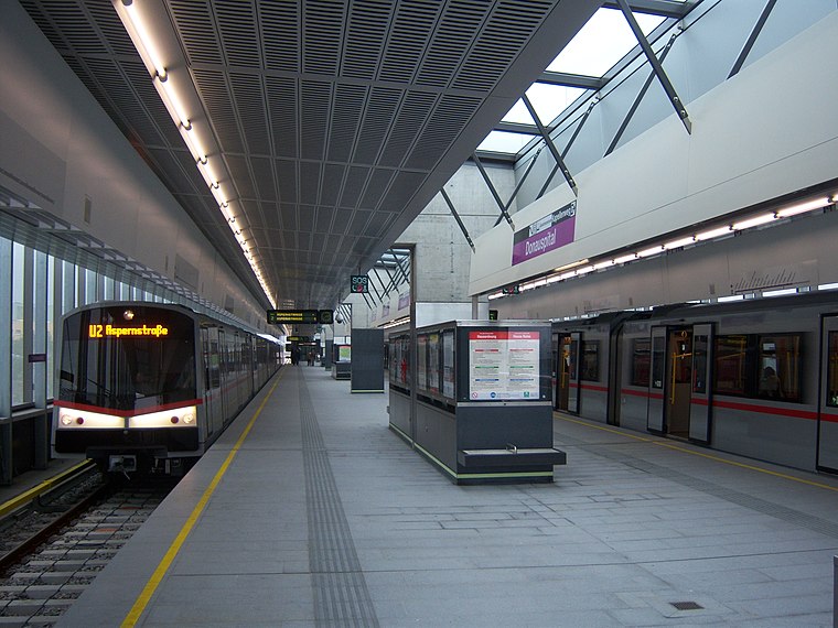
Photo: My Friend, CC BY-SA 3.0.
Donauspital is a station on the U2 of the Vienna U-Bahn. It is located in Aspern, Donaustadt, the 22nd district of Vienna. The station was opened in 2010 as part of the third expansion of the U2 between Stadion and Aspernstraße. Donauspital station is situated 700 metres south of Chinesische Evangelikale Gemeinde Wien.
Aspernstraße station
Metro station

Photo: My Friend, CC BY-SA 3.0.
Aspernstraße is a station on the U2 of the Vienna U-Bahn. It is located in Aspern, Donaustadt, the 22nd district of Vienna. The station was opened on 2 October 2010 as part of the third expansion of the U2 between Stadion and Aspernstraße. Aspernstraße station is situated 780 metres southeast of Chinesische Evangelikale Gemeinde Wien.
Hardeggasse station
Metro station
 Hardeggasse is a station on the U2 of the Vienna U-Bahn. It is located in Donaustadt, the 22nd district of Vienna. The station was opened on 2 October 2010 as part of the third expansion of the U2 between Stadion and Aspernstraße. Hardeggasse station is situated 780 metres southwest of Chinesische Evangelikale Gemeinde Wien.
Places in the Area
Nearby places include Wulzendorf and Seestadt Aspern.

Seestadt Aspern
Suburb
 Seestadt Aspern is a significant urban development project under construction within the Vienna's 22nd city district, Donaustadt, Vienna, Austria. It is one of the largest ongoing urban development projects in Europe. Seestadt Aspern is situated 3 km east of Chinesische Evangelikale Gemeinde Wien.
Outer East

Photo: D.W., Public domain.
Outer East describes the Vienna districts Floridsdorf and Donaustadt.
Chinesische Evangelikale Gemeinde Wien
- Type: Church
- Address: Erzherzog-Karl-Straße 171, Wien, 1220
- Categories: place of worship and religion
- Location: Donaustadt, Vienna, Austria, Central Europe, Europe
- View on OpenStreetMap
Latitude
48.22569° or 48° 13′ 33″ northLongitude
16.46549° or 16° 27′ 56″ eastOpen location code
8FWR6FG8+75OpenStreetMap ID
node 4920134972OpenStreetMap feature
amenity=place_of_worship
This page is based on OpenStreetMap, Wikidata, and Wikimedia Commons.
We’d love your help improving our open data sources. Thank you for contributing.
Satellite Map
Discover Chinesische Evangelikale Gemeinde Wien from above in high-definition satellite imagery.
Notable Places Nearby
Highlights include Stadtbücherei Stadlau and Hauptfeuerwache Donaustadt.
Nearby Places
Explore places such as Wok House and Hartlebengasse.
Vienna: Must-Visit Destinations
Delve into Innere Stadt, Vienna International Airport, Inner East, and Hietzing.
Curious Churches to Discover
Uncover intriguing churches from every corner of the globe.
About Mapcarta. Data © OpenStreetMap contributors and available under the Open Database License". Text is available under the CC BY-SA 4.0 license, except for photos, directions, and the map. Photo: Jebulon, CC0.