Untere Fußgängerzone
Untere Fußgängerzone is a bike rental in Bensheim, Bergstraße, Hesse. Untere Fußgängerzone is situated nearby to Storchennest, as well as near the government office Familienzentrum Bensheim e.V..| Tap on a place to explore it |
Places of Interest Nearby
Highlights include Hospitalkirche St. Joseph and St. Crescens.
Hospitalkirche St. Joseph
Church

Photo: Kuebi, CC BY-SA 3.0.
Hospitalkirche St. Joseph is a church, which is situated 120 metres northwest of Untere Fußgängerzone.
St. Crescens
Church

Photo: Kuebi, CC BY-SA 3.0.
St. Crescens is a church, which is situated 250 metres southeast of Untere Fußgängerzone.
Bensheim station
Railway station
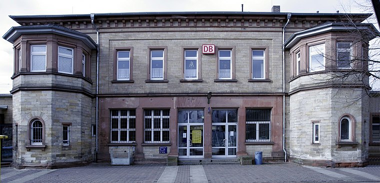
Photo: Wikimedia, CC BY-SA 3.0.
Bensheim station is in the town of Bensheim on the Main-Neckar Railway, connecting Frankfurt and Heidelberg, in the German state of Hesse. The station is also the beginning and end of the single-track non-electrified Worms–Bensheim line. Bensheim station is situated 530 metres northwest of Untere Fußgängerzone.
Places in the Area
Nearby places include Unter-Hambach and Heppenheim.
Unter-Hambach
Neighborhood

Photo: Kuebi, CC BY-SA 3.0.
Unter-Hambach is a neighborhood, which is situated 3½ km southeast of Untere Fußgängerzone.
Heppenheim

Photo: Berthold Werner, CC BY-SA 3.0.
Heppenheim is a town in South Hesse, Germany along the Bergstraße, a mountain road running on the western edge of the Odenwald mountain range.
Schwanheim
Village

Photo: Kuebi, CC BY-SA 3.0.
Schwanheim is a village, which is situated 4½ km northwest of Untere Fußgängerzone.
Untere Fußgängerzone
- Email: info@nextbike.de
- Type: Bike rental
- Category: transportation
- Location: Bensheim, Bergstraße, South Hesse, Hesse, Germany, Central Europe, Europe
- View on OpenStreetMap
Latitude
49.67806° or 49° 40′ 41″ northLongitude
8.62222° or 8° 37′ 20″ eastBrand
VRNnextbikeOperator
NextbikeNetwork
VRNnextbikeOpen location code
8FXCMJHC+6VOpenStreetMap ID
node 4929832236OpenStreetMap feature
amenity=bicycle_rental
This page is based on OpenStreetMap, Wikidata, and Wikimedia Commons.
We’d love your help improving our open data sources. Thank you for contributing.
Satellite Map
Discover Untere Fußgängerzone from above in high-definition satellite imagery.
Notable Places Nearby
Highlights include Storchennest and Familienzentrum Bensheim e.V..
Nearby Places
Explore places such as Wölfe in Deutschland and Hauptstraße 93.
South Hesse: Must-Visit Destinations
Delve into Darmstadt, Lorsch, Heppenheim, and Dreieich.
Curious Bike Rentals to Discover
Uncover intriguing bike rentals from every corner of the globe.
About Mapcarta. Data © OpenStreetMap contributors and available under the Open Database License". Text is available under the CC BY-SA 4.0 license, except for photos, directions, and the map. Photo: Kesslerbensheim, CC BY-SA 4.0.