Lower Kloof
Lower Kloof is a bus stop in City of Cape Town, Western Cape. Lower Kloof is situated nearby to Jubilee Community Church, as well as near Hippo Boutique Hotel.| Tap on a place to explore it |
Places of Interest Nearby
Highlights include Iziko South African Museum and Labia Theatre.
Iziko South African Museum
Museum
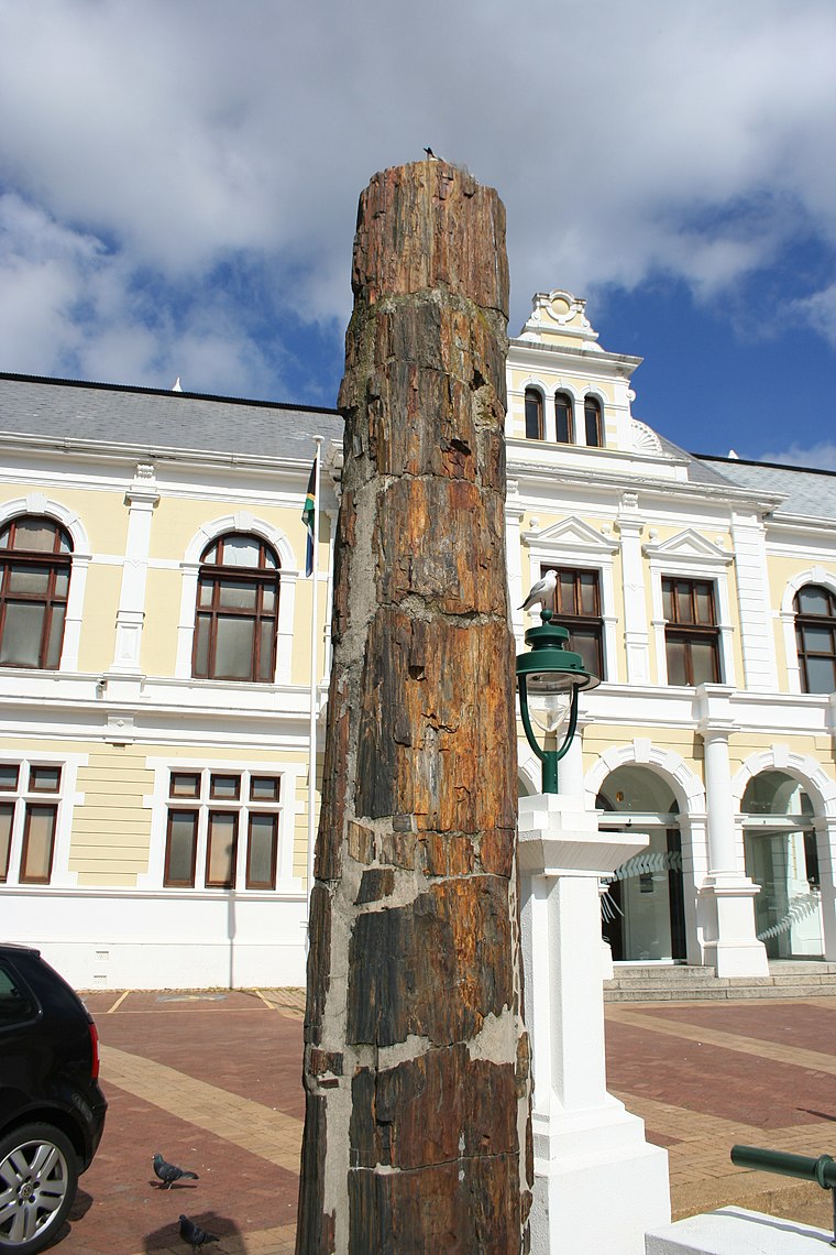
Photo: Discott, CC BY-SA 3.0.
The Iziko South African Museum, formerly the South African Museum, is a South African national museum located in Cape Town. The museum was founded in 1825, the first in the country. Iziko South African Museum is situated 270 metres east of Lower Kloof.
Labia Theatre
Movie theater

Photo: Ben Sutherland, CC BY 2.0.
The Labia Theatre is one of the oldest independent movie theatres in Cape Town, South Africa. It is situated in Gardens, an inner-city suburb in the City Bowl. Labia Theatre is situated 170 metres south of Lower Kloof.
French Consulate
Government office
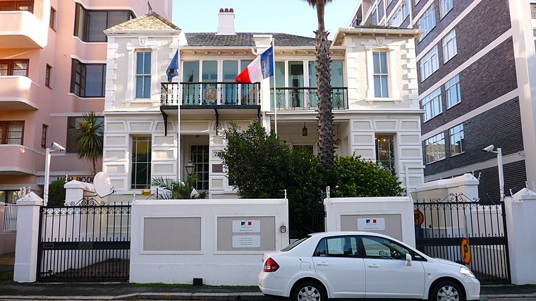
Photo: Snazzledizzle, CC BY-SA 3.0.
The Consulate General of France in Cape Town is a consular representation of the French Republic in South Africa. The consular district includes the three Cape provinces, Prince Edward Islands and the British territory of Saint Helena. French Consulate is situated 290 metres east of Lower Kloof.
Places in the Area
Nearby places include Schotsche Kloof and Cape Town.
Schotsche Kloof
Suburb
The Bo-Kaap is an area of Cape Town, South Africa formerly known as the Malay Quarter. It is a former racially segregated area, situated on the slopes of Signal Hill above the city centre and is a historical centre of Cape Malay culture in Cape Town.
Cape Town
 Cape Town is the second most populous city in South Africa. The capital of Western Cape Province, it is also the legislative capital of the nation. Cape Town is on South Africa's southwestern coast close to the Cape of Good Hope, and is the southernmost city on the African continent.
Foreshore
Suburb
The Foreshore is an area in Cape Town, South Africa, situated in the city's central business district, between the historic city centre and the Port of Cape Town. Foreshore is situated 2½ km east of Lower Kloof.
Lower Kloof
- Type: Bus stop
- Category: transportation
- Location: City of Cape Town, Western Cape, South Africa, Southern Africa, Africa
- View on OpenStreetMap
Latitude
-33.9285° or 33° 55′ 43″ southLongitude
18.41212° or 18° 24′ 44″ eastOperator
MyCiTiNetwork
Cape Town IRTOpen location code
4FRW3CC6+JROpenStreetMap ID
node 4934302221OpenStreetMap feature
highway=bus_stopOpenStreetMap feature
public_transport=platform
This page is based on OpenStreetMap, Wikidata, and Wikimedia Commons.
We’d love your help improving our open data sources. Thank you for contributing.
Satellite Map
Discover Lower Kloof from above in high-definition satellite imagery.
Places with the Same Name
Discover other places named “Lower Kloof”.
Notable Places Nearby
Highlights include Jubilee Community Church and Museum of Illusions.
Nearby Places
Explore places such as Lower Kloof and Workshop17 Kloof Street.
Western Cape: Must-Visit Destinations
Delve into Cape Town, Robben Island, Stellenbosch, and George.
Curious Bus Stops to Discover
Uncover intriguing bus stops from every corner of the globe.
About Mapcarta. Data © OpenStreetMap contributors and available under the Open Database License". Text is available under the CC BY-SA 4.0 license, except for photos, directions, and the map. Photo: Wikimedia, CC BY-SA 3.0.