Kirsan
Kirsan is an office in Moldova which is located on Strada Alexandru Hâjdeu. Kirsan is situated nearby to the hospital Chisinau Public Health Center, as well as near St. George church in Chișinău.| Tap on a place to explore it |
Places of Interest Nearby
Highlights include St. George church in Chișinău and Rabbi Tsirelson Synagogue Ruins.
St. George church in Chișinău
Church

Photo: Tolea93, CC BY-SA 4.0.
St. George church in Chișinău is situated 170 metres south of Kirsan.
Rabbi Tsirelson Synagogue Ruins

Photo: Loraine, CC BY-SA 4.0.
Rabbi Tsirelson Synagogue Ruins is situated 370 metres northwest of Kirsan.
Synagogue of the Glaziers, Chișinău
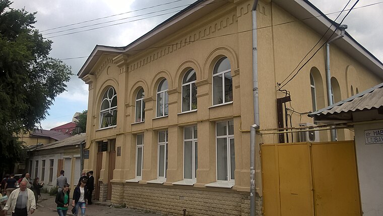
Photo: Loraine, CC BY-SA 4.0.
Synagogue of the Glaziers, Chișinău is situated 510 metres west of Kirsan.
Places in the Area
Nearby places include Sectorul Centru and Chișinău.
Sectorul Centru
Suburb
Photo: Борис Мавлютов, CC BY-SA 3.0.
Sectorul Centru is one of the five sectors in Chișinău, the capital of Moldova. The local administration is managed by a pretor appointed by the city administration.
Chișinău

Photo: Zserghei, Public domain.
Chișinău, pronounced "Kishinau" with "nau" as in the English word "now", is the capital of Moldova with a population of around 780,000 in the metro area, and 250,000 people coming each day for work and entertainment.
Sectorul Rîșcani
Suburb

Photo: Zserghei, Public domain.
Sectorul Rîșcani is one of the five sectors in Chișinău, the capital of Moldova. The local administration is managed by a pretor appointed by the city administration. Sectorul Rîșcani is situated 3 km north of Kirsan.
Kirsan
Latitude
47.02343° or 47° 1′ 24″ northLongitude
28.84913° or 28° 50′ 57″ eastOpen location code
8GVC2RFX+9MOpenStreetMap ID
node 4936679323OpenStreetMap feature
office=company
This page is based on OpenStreetMap, Wikidata, and Wikimedia Commons.
We’d love your help improving our open data sources. Thank you for contributing.
Satellite Map
Discover Kirsan from above in high-definition satellite imagery.
In Other Languages
“Kirsan” goes by many names.
- Romanian: “Kirsan”
Places with the Same Name
Discover other places named “Kirsan”.
Notable Places Nearby
Highlights include Chisinau Public Health Center and Biblioteca Universității Divitia Gratiae.
Nearby Places
Explore places such as Liceul Teoretic „Kiril și Metodiu” and Școala Fotomax.
Moldova: Must-Visit Destinations
Delve into Transnistria, Chișinău, Tiraspol, and Bălţi.
Curious Places to Discover
Uncover intriguing places from every corner of the globe.
About Mapcarta. Data © OpenStreetMap contributors and available under the Open Database License". Text is available under the CC BY-SA 4.0 license, except for photos, directions, and the map. Photo: USAID Digital Development, CC BY 2.0.