Tagesstätte Bünde
Tagesstätte Bünde is a government office in Bünde, Herford, North Rhine-Westphalia which is located on Bismarckstraße. Tagesstätte Bünde is situated nearby to the library Stadtbücherei Bünde, as well as near the cemetery Stadt- und Amtsfriedhof.| Tap on a place to explore it |
- Type: Government office
- Address: Bismarckstraße 7, Bünde, 32257
- Wheelchair access: no
Places of Interest Nearby
Highlights include Laurentiuskirche and Deutsches Tabak- und Zigarrenmuseum.
Laurentiuskirche
Church
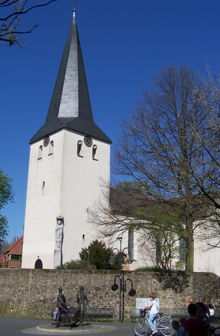
Photo: Ohannes, CC BY-SA 3.0.
Laurentiuskirche is a church, which is situated 330 metres southwest of Tagesstätte Bünde.
Deutsches Tabak- und Zigarrenmuseum
Museum

Photo: Ohannes, CC BY-SA 3.0.
Deutsches Tabak- und Zigarrenmuseum is situated 510 metres southwest of Tagesstätte Bünde.
Lukas-Krankenhaus Bünde
Hospital

Photo: Wikimedia, CC BY-SA 3.0 de.
Lukas-Krankenhaus Bünde is a hospital, which is situated 660 metres east of Tagesstätte Bünde.
Places in the Area
Nearby places include Dünne and Kirchlengern.
Dünne
Suburb

Photo: Chris06, CC BY-SA 4.0.
Dünne is a suburb, which is situated 3 km north of Tagesstätte Bünde.
Kirchlengern
Town

Photo: Smial, CC BY-SA 2.0 de.
Kirchlengern is a municipality in the district of Herford, in North Rhine-Westphalia, Germany. Kirchlengern is situated 4 km east of Tagesstätte Bünde.
Besenkamp
Suburb

Photo: Chris06, Public domain.
Besenkamp is a suburb, which is situated 4½ km south of Tagesstätte Bünde.
Tagesstätte Bünde
- Categories: office and government building
- Location: Bünde, Herford, Detmold, North Rhine-Westphalia, Germany, Central Europe, Europe
- View on OpenStreetMap
Latitude
52.19947° or 52° 11′ 58″ northLongitude
8.58517° or 8° 35′ 7″ eastOpen location code
9F4C5HXP+Q3OpenStreetMap ID
node 4936705726OpenStreetMap feature
office=governmentOpenStreetMap attribute
wheelchair=no
This page is based on OpenStreetMap, Wikidata, and Wikimedia Commons.
We’d love your help improving our open data sources. Thank you for contributing.
Satellite Map
Discover Tagesstätte Bünde from above in high-definition satellite imagery.
Notable Places Nearby
Highlights include Stadtbücherei Bünde and Stadt- und Amtsfriedhof.
Nearby Places
Explore places such as Dr. med. Kleinemeier and Facharzt für Frauenheilkunde und Geburtshilfe - Dr. M. Rabbatah.
North Rhine-Westphalia: Must-Visit Destinations
Delve into Cologne, Düsseldorf, Bonn, and Dortmund.
Curious Government Offices to Discover
Uncover intriguing government offices from every corner of the globe.
About Mapcarta. Data © OpenStreetMap contributors and available under the Open Database License". Text is available under the CC BY-SA 4.0 license, except for photos, directions, and the map. Photo: Daniel Schwen, CC BY-SA 2.5.