Tumulus T1 et T2
Tumulus T1 et T2 is an archaeological site in Lannemezan, Arrondissement of Bagnères-de-Bigorre, Occitanie. Tumulus T1 et T2 is situated nearby to the golf course Golf de Lannemezan, as well as near the sports venue Hippodrome de la Demi-Lune.| Tap on a place to explore it |
Places of Interest Nearby
Highlights include Lannemezan station and Église de la Nativité-de-la-Vierge de Pinas.
Lannemezan station
Railway station

Photo: Lunon92, CC BY-SA 3.0.
Lannemezan is a railway station in Lannemezan, Occitanie, France. The station is on the Toulouse–Bayonne railway line and the former Lannemezan–Arreau railway line. The station is served by Intercités and TER services operated by the SNCF. Lannemezan station is situated 2½ km west of Tumulus T1 et T2.
Église de la Nativité-de-la-Vierge de Pinas
Church

Photo: Florent Pécassou, CC BY-SA 3.0.
Église de la Nativité-de-la-Vierge de Pinas is a church, which is situated 1½ km northeast of Tumulus T1 et T2.
Église de l’Assomption de Cantaous
Church

Photo: Sotos, CC BY-SA 4.0.
Église de l’Assomption de Cantaous is a church, which is situated 2 km east of Tumulus T1 et T2.
Places in the Area
Nearby places include Pinas and Cantaous.
Pinas
Village
Photo: Florent Pécassou, CC BY-SA 3.0.
Pinas is a commune in the Hautes-Pyrénées department in south-western France.
Cantaous
Village

Photo: Sotos, CC BY-SA 4.0.
Cantaous is a commune in the Hautes-Pyrénées department in south-western France.
Lannemezan
Village
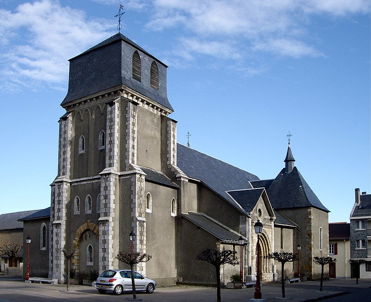
Photo: Florent Pécassou, CC BY-SA 3.0.
Lannemezan is a commune in the Hautes-Pyrénées department and the Occitanie region in south-western France. The inhabitants are called Lannemezanais. Lannemezan is the largest city in the Communauté de communes du Plateau de Lannemezan. Lannemezan is situated 3½ km northwest of Tumulus T1 et T2.
Tumulus T1 et T2
- Type: Archaeological site
- Description: tumulus located in Hautes-Pyrénées, in France
- Categories: tumulus, historic site, tourist attraction, and tourism
- Location: Lannemezan, Arrondissement of Bagnères-de-Bigorre, Hautes-Pyrénées, Occitanie, France, Europe
- View on OpenStreetMap
Latitude
43.10725° or 43° 6′ 26″ northLongitude
0.4166° or 0° 24′ 60″ eastOpen location code
8FM24C48+VJOpenStreetMap ID
node 4958231647OpenStreetMap feature
historic=archaeological_siteWikidata ID
Q22939937
This page is based on OpenStreetMap, Wikidata, and Wikimedia Commons.
We’d love your help improving our open data sources. Thank you for contributing.
Satellite Map
Discover Tumulus T1 et T2 from above in high-definition satellite imagery.
In Other Languages
From Catalan to French—“Tumulus T1 et T2” goes by many names.
- Catalan: “Túmul funerari T1 i T2 (Lanamesa)”
- Catalan: “Túmul funerari T1 i T2”
- French: “tumulus T1 et T2 de Lannemezan”
- French: “Tumulus T1 et T2 de Lannemezan”
Notable Places Nearby
Highlights include Golf de Lannemezan and Hippodrome de la Demi-Lune.
Nearby Places
Explore places such as Le Pré vert and V81.
Hautes-Pyrénées: Must-Visit Destinations
Delve into Lourdes, Tarbes, Bagnères-de-Bigorre, and Pyrénées National Park.
Curious Archaeological Sites to Discover
Uncover intriguing archaeological sites from every corner of the globe.
About Mapcarta. Data © OpenStreetMap contributors and available under the Open Database License". Text is available under the CC BY-SA 4.0 license, except for photos, directions, and the map. Photo: JLPC, CC BY-SA 3.0.