Hadrells Point tackle
Hadrells Point tackle is a sport shop in Charleston County, South Carolina. Hadrells Point tackle is situated nearby to West Ashley Branch Library, as well as near Holy Trinity Episcopal Church.| Tap on a place to explore it |
Places of Interest Nearby
Highlights include The Citadel and Brittlebank Park.
The Citadel
College
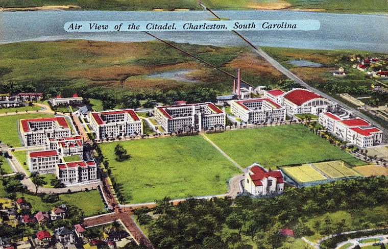
Photo: Wikimedia, Public domain.
The Citadel Military College of South Carolina is a public senior military college in Charleston, South Carolina, United States. Established in 1842, it is the third oldest of the six senior military colleges in the United States. The Citadel is situated 1½ miles northeast of Hadrells Point tackle.
Brittlebank Park
Park

Photo: ProfReader, CC BY-SA 4.0.
Brittlebank Park is a ten-acre park located between Lockwood Boulevard and the Ashley River in Charleston, South Carolina near Gadsden Creek. To the south is a condominium project and to the north is the minor league baseball stadium, the Joseph P. Riley Jr. Park. Brittlebank Park is situated 1¼ miles northeast of Hadrells Point tackle.
Joseph P. Riley Jr. Park
Stadium

Photo: Billcasey905, CC BY-SA 3.0.
Joseph P. Riley Jr. Park is a baseball stadium located in Charleston, South Carolina. The stadium is named after Charleston's longest-serving mayor, Joseph P. Joseph P. Riley Jr. Park is situated 1¼ miles northeast of Hadrells Point tackle.
Places in the Area
Nearby places include Riverland Terrace and Hampton Park Terrace.
Riverland Terrace
Hamlet
Riverland Terrace is a historic neighborhood in Charleston, South Carolina. It was first developed starting in 1925. It is one of James Island, South Carolina's oldest neighborhoods.
Hampton Park Terrace
Neighborhood

Photo: ProfReader, CC BY-SA 3.0.
Hampton Park Terrace is the name both of a neighborhood and a National Register district located in peninsular Charleston, South Carolina. The neighborhood is bounded on the west by The Citadel, on the north by Hampton Park, on the east by Rutledge Ave, and on the south by Congress St. Hampton Park Terrace is situated 2 miles northeast of Hadrells Point tackle.
Charleston
 Charleston is the largest and oldest city in the state of South Carolina in the United States of America. Its historic downtown is on a peninsula formed by two rivers, the Ashley and the Cooper, flowing into the Atlantic, and protected from the open ocean by surrounding islands.
Hadrells Point tackle
- Type: Sport shop
- Category: shop
- Location: Charleston County, South Carolina, South, United States, North America
- View on OpenStreetMap
Latitude
32.77662° or 32° 46′ 36″ northLongitude
-79.97611° or 79° 58′ 34″ westOpen location code
8742Q2GF+JHOpenStreetMap ID
node 4973908524OpenStreetMap feature
shop=sports
This page is based on OpenStreetMap, Wikidata, and Wikimedia Commons.
We’d love your help improving our open data sources. Thank you for contributing.
Satellite Map
Discover Hadrells Point tackle from above in high-definition satellite imagery.
Notable Places Nearby
Highlights include West Ashley Branch Library and Holy Trinity Episcopal Church.
Nearby Places
Explore places such as Normandy Farm Bakery and Earth Fare.
South Carolina: Must-Visit Destinations
Delve into Columbia, Charleston, Greenville, and Myrtle Beach.
Curious Sport Shops to Discover
Uncover intriguing sport shops from every corner of the globe.
About Mapcarta. Data © OpenStreetMap contributors and available under the Open Database License". Text is available under the CC BY-SA 4.0 license, except for photos, directions, and the map. Photo: Rastapopulous, CC BY-SA 3.0.