Wandern mit Tram und Bus
Wandern mit Tram und Bus is in Wetzelsdorf, Graz, Styria. Wandern mit Tram und Bus is situated nearby to the post office Post Filiale 8052, as well as near the health club Bodystreet Graz Wetzelsdorf.| Tap on a place to explore it |
Places of Interest Nearby
Highlights include Allerheiligenkirche, Graz and Schutzengelkirche.
Allerheiligenkirche, Graz
Church

Photo: Wolf32at, CC BY-SA 3.0.
Allerheiligenkirche, Graz is a church, which is situated 1 km northwest of Wandern mit Tram und Bus.
Schutzengelkirche
Church

Photo: Andi oisn, CC BY-SA 3.0.
Schutzengelkirche is a church, which is situated 1 km north of Wandern mit Tram und Bus.
Christuskirche
Church

Photo: Andi oisn, CC BY-SA 3.0.
Christuskirche is a church, which is situated 1 km north of Wandern mit Tram und Bus.
Places in the Area
Nearby places include Eggenberg and Wetzelsdorf.
Eggenberg
Suburb
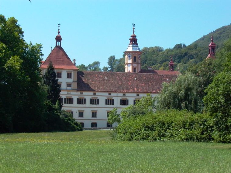
Photo: Robodoc, CC BY-SA 3.0.
Eggenberg is the 14th city district of Graz in the Austrian province of Styria. It borders to the districts of Lend and Gries in the east and to the Plabutsch mountain in the west.
Wetzelsdorf
Suburb
Wetzelsdorf is the 15th city district of Graz, Austria. It is located in the west part of the city between the districts of Eggenberg to the north and Straßgang to the south.
Graz Reininghaus
Neighborhood

Photo: Wikimedia, CC BY-SA 3.0 de.
The grounds of the former Reininghaus brewery, covering 50 hectares, represent the largest undeveloped area near the center of Graz, Austria’s second largest city.
Wandern mit Tram und Bus
- Type: Map
- Categories: information and tourism
- Location: Wetzelsdorf, Graz, Styria, Austria, Central Europe, Europe
- View on OpenStreetMap
Latitude
47.06045° or 47° 3′ 38″ northLongitude
15.39248° or 15° 23′ 33″ eastOperator
Oesterr. Alpenverein, Sektion GrazOpen location code
8FVQ396R+5XOpenStreetMap ID
node 4987805616OpenStreetMap feature
tourism=information
This page is based on OpenStreetMap, Wikidata, and Wikimedia Commons.
We’d love your help improving our open data sources. Thank you for contributing.
Satellite Map
Discover Wandern mit Tram und Bus from above in high-definition satellite imagery.
Places with the Same Name
Discover other places named “Wandern mit Tram und Bus”.
Notable Places Nearby
Highlights include Post Filiale 8052 and Bodystreet Graz Wetzelsdorf.
Nearby Places
Explore places such as Unterwerk Wetzelsdorf and Wetzelsdorf.
Styria: Must-Visit Destinations
Delve into Leoben, Bruck an der Mur, Kapfenberg, and Schladming.
Curious Places to Discover
Uncover intriguing places from every corner of the globe.
About Mapcarta. Data © OpenStreetMap contributors and available under the Open Database License". Text is available under the CC BY-SA 4.0 license, except for photos, directions, and the map. Photo: Traveler100, CC BY-SA 3.0.