TV Kaltenrieder Electronic
TV Kaltenrieder Electronic is an electronics store in Morges, Vaud. TV Kaltenrieder Electronic is situated nearby to the railway station Morges, as well as near the bridge Pont-Neuf.| Tap on a place to explore it |
Places of Interest Nearby
Highlights include Morges railway station and Morges Castle.
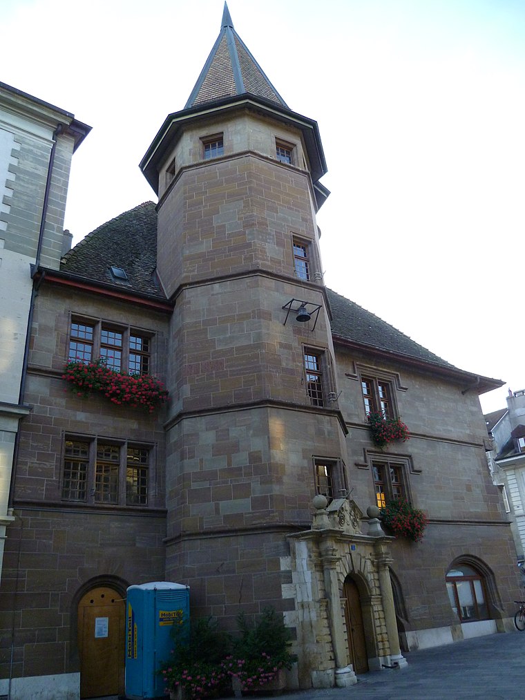
Morges railway station
Railway station

Photo: Stedewa, CC BY-SA 4.0.
Morges railway station is a railway station in the municipality of Morges, in the Swiss canton of Vaud. It is an intermediate stop on the standard gauge Lausanne–Geneva line of Swiss Federal Railways and the eastern terminus of the 1,000 mm gauge Bière–Apples–Morges line of Transports de la région Morges-Bière-Cossonay.
Morges Castle
Castle

Photo: Pierre Bona, CC BY-SA 3.0.
Morges Castle is a medieval castle in the Swiss municipality of Morges in the canton of Vaud. It is a Swiss heritage site of national significance. Morges Castle is situated 500 metres southeast of TV Kaltenrieder Electronic.
Hôtel de ville, Morges
Town hall
 Hôtel de ville, Morges is a town hall, which is situated 410 metres southeast of TV Kaltenrieder Electronic.
Places in the Area
Nearby places include Morges and Chigny.
Morges
Town

Photo: Slatin, CC BY-SA 3.0.
Morges is a municipality in the Swiss canton of Vaud and the seat of the district of Morges. It is located on Lake Geneva, west of Lausanne.
Chigny
Village
 Chigny is a municipality in the Swiss canton of Vaud, located in the district of Morges.
Tolochenaz
Village

Photo: Koichi Shibata, CC BY-SA 3.0.
Tolochenaz is a municipality in the Swiss canton of Vaud, located in the district of Morges.
TV Kaltenrieder Electronic
- Type: Electronics store
- Category: shop
- Location: Morges, Morges District, Vaud, Western Switzerland, Switzerland, Central Europe, Europe
- View on OpenStreetMap
Latitude
46.51062° or 46° 30′ 38″ northLongitude
6.49355° or 6° 29′ 37″ eastOpen location code
8FR8GF6V+6COpenStreetMap ID
node 4997604045OpenStreetMap feature
shop=electronics
This page is based on OpenStreetMap, Wikidata, and Wikimedia Commons.
We’d love your help improving our open data sources. Thank you for contributing.
Satellite Map
Discover TV Kaltenrieder Electronic from above in high-definition satellite imagery.
Notable Places Nearby
Highlights include Morges and Pont-Neuf.
Nearby Places
Explore places such as DynaConcept Informatique and Allianz.
Vaud: Must-Visit Destinations
Delve into Lausanne, Montreux, Nyon, and Vevey.
Curious Electronics Stores to Discover
Uncover intriguing electronics stores from every corner of the globe.
About Mapcarta. Data © OpenStreetMap contributors and available under the Open Database License". Text is available under the CC BY-SA 4.0 license, except for photos, directions, and the map. Photo: Annickjaquillard, CC BY-SA 4.0.