Klingenbichl
Klingenbichl is in Oberstdorf, Oberallgäu, Bavaria. Klingenbichl is situated nearby to the hill Burgbichel, as well as near the school Gertrud-von-le-Fort-Gymnasium.| Tap on a place to explore it |
Places of Interest Nearby
Highlights include Gertrud-von-le-Fort-Gymnasium and St. Nikolaus.
Gertrud-von-le-Fort-Gymnasium
School
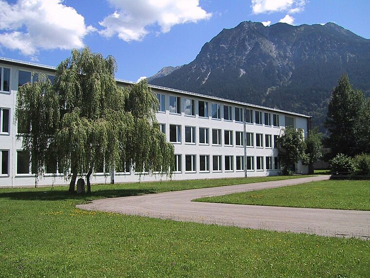 Gertrud-von-le-Fort-Gymnasium is a school, which is situated 520 metres east of Klingenbichl.
St. Nikolaus
Church

Photo: Ricardalovesmonuments, CC BY-SA 4.0.
St. Nikolaus is a church, which is situated 1 km southeast of Klingenbichl.
Oberstdorf station
Station

Photo: SB68Manm, CC BY-SA 3.0.
Oberstdorf station is the station of the Bavarian market town of Oberstdorf in the German state of Bavaria. It has five platforms and is classified by Deutsche Bahn as a category 3 station. Oberstdorf station is situated 1 km southeast of Klingenbichl.
Places in the Area
Nearby places include Jauchen and Oberstdorf.


Klingenbichl
- Type: Sign
- Categories: information and tourism
- Location: Oberstdorf, Oberallgäu, Bavarian Swabia, Bavaria, Germany, Central Europe, Europe
- View on OpenStreetMap
Latitude
47.41733° or 47° 25′ 2″ northLongitude
10.26941° or 10° 16′ 10″ eastElevation
790 metres (2,592 feet)Open location code
8FVGC789+WQOpenStreetMap ID
node 5024169304OpenStreetMap feature
tourism=information
This page is based on OpenStreetMap, Wikidata, and Wikimedia Commons.
We’d love your help improving our open data sources. Thank you for contributing.
Satellite Map
Discover Klingenbichl from above in high-definition satellite imagery.
Notable Places Nearby
Highlights include Burgbichel and Adula-Klinik.
Nearby Places
Explore places such as Haus Alpenpanorama and Wertstoffhof Oberstdorf.
Bavarian Swabia: Must-Visit Destinations
Delve into Augsburg, Memmingen, Kempten, and Füssen.
Curious Places to Discover
Uncover intriguing places from every corner of the globe.
About Mapcarta. Data © OpenStreetMap contributors and available under the Open Database License". Text is available under the CC BY-SA 4.0 license, except for photos, directions, and the map. Photo: Wikimedia, Public domain.