Schneiderei Atelier STAS
Schneiderei Atelier STAS is a tailor shop in Bielefeld, Detmold, North Rhine-Westphalia which is located on Gadderbaumer Straße. Schneiderei Atelier STAS is situated nearby to the museum Dr. Oetker Welt, as well as near School of Arts and Crafts Bielefeld.| Tap on a place to explore it |
Places of Interest Nearby
Highlights include Sparrenberg Castle and Kunsthalle Bielefeld.
Sparrenberg Castle

Photo: Carsten Steger, CC BY-SA 4.0.
Sparrenberg Castle, also known as the Sparrenburg, is a restored fortress in the Bielefeld-Mitte district of Bielefeld, Germany. It is situated on the Sparrenberg hill in the Teutoburg Forest and towers 60 metres above the city centre. Sparrenberg Castle is situated 260 metres east of Schneiderei Atelier STAS.
Kunsthalle Bielefeld
Museum
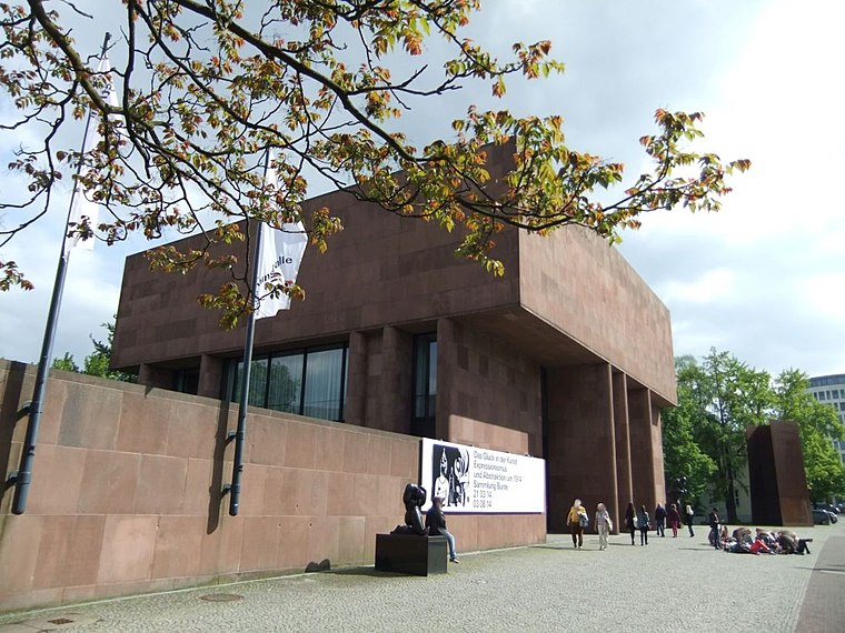
Photo: Bielibob, CC BY-SA 3.0.
The Kunsthalle Bielefeld is a modern and contemporary art museum in Bielefeld, Germany. It was designed by Philip Johnson in 1968, and paid for by the businessman and art patron Rudolf August Oetker. Kunsthalle Bielefeld is situated 420 metres northeast of Schneiderei Atelier STAS.
School of Arts and Crafts Bielefeld
School
 School of Arts and Crafts Bielefeld is situated 140 metres east of Schneiderei Atelier STAS.
Places in the Area
Nearby places include Bethel and Dornberg.

Dornberg
Suburb

Photo: Ansgar Walk, CC BY-SA 2.0 de.
Dornberg is a suburb, which is situated 5 km northwest of Schneiderei Atelier STAS.
Lämershagen-Gräfinghagen
Quarter

Photo: Grugerio, CC BY-SA 3.0.
Lämershagen-Gräfinghagen is a quarter, which is situated 7 km southeast of Schneiderei Atelier STAS.
Schneiderei Atelier STAS
- Type: Tailor shop
- Address: Gadderbaumer Straße 30, Bielefeld, 33602
- Category: shop
- Location: Bielefeld, Detmold, Teutoburg Forest, North Rhine-Westphalia, Germany, Central Europe, Europe
- View on OpenStreetMap
Latitude
52.01499° or 52° 0′ 54″ northLongitude
8.52277° or 8° 31′ 22″ eastOpen location code
9F4C2G7F+X4OpenStreetMap ID
node 5031219504OpenStreetMap feature
shop=tailor
This page is based on OpenStreetMap, Wikidata, and Wikimedia Commons.
We’d love your help improving our open data sources. Thank you for contributing.
Satellite Map
Discover Schneiderei Atelier STAS from above in high-definition satellite imagery.
Notable Places Nearby
Highlights include Dr. Oetker Welt and Haus Gilead I.
Nearby Places
Explore places such as Kuhles und Berger Zahntechnik and Stilraum.
Teutoburg Forest: Must-Visit Destinations
Delve into Paderborn, Detmold, Gütersloh, and Minden.
Curious Places to Discover
Uncover intriguing places from every corner of the globe.
About Mapcarta. Data © OpenStreetMap contributors and available under the Open Database License". Text is available under the CC BY-SA 4.0 license, except for photos, directions, and the map. Photo: Wikimedia, CC0.