Waiern Abzw Krankenhaus
Waiern Abzw Krankenhaus is a bus stop in Feldkirchen in Kärnten, Feldkirchen District, Carinthia. Waiern Abzw Krankenhaus is situated nearby to the church Kirche in Waiern, as well as near the cemetery Evang. Friedhof Waiern.| Tap on a place to explore it |
Places of Interest Nearby
Highlights include Kirche in Waiern and Pfarrkirche Maria im Dorn.
Kirche in Waiern
Church

Photo: Johann Jaritz, CC BY-SA 4.0.
Kirche in Waiern is a church, which is situated 280 metres east of Waiern Abzw Krankenhaus.
Pfarrkirche Maria im Dorn
Church

Photo: Johann Jaritz, CC BY-SA 3.0 at.
Pfarrkirche Maria im Dorn is a church, which is situated 1¼ km east of Waiern Abzw Krankenhaus.
Amthof, Feldkirchen
Arts center

Photo: Bachera2, CC BY-SA 3.0.
Amthof, Feldkirchen is an arts center, which is situated 1½ km southeast of Waiern Abzw Krankenhaus.
Places in the Area
Nearby places include Tiffen and Steindorf am Ossiacher See.
Tiffen
Village

Photo: Rollroboter, CC BY-SA 4.0.
Tiffen is a cadastral municipality in Steindorf am Ossiacher See, in the district of Feldkirchen in the Austrian state of Carinthia. Tiffen is situated 3 km southwest of Waiern Abzw Krankenhaus.
Steindorf am Ossiacher See
Village

Photo: Kliek, CC BY-SA 4.0.
Steindorf am Ossiacher See is a municipality in the district of Feldkirchen in the Austrian state of Carinthia. It is the home of the Teuffenbach royal family. Steindorf am Ossiacher See is situated 7 km southwest of Waiern Abzw Krankenhaus.
Ossiach
Village
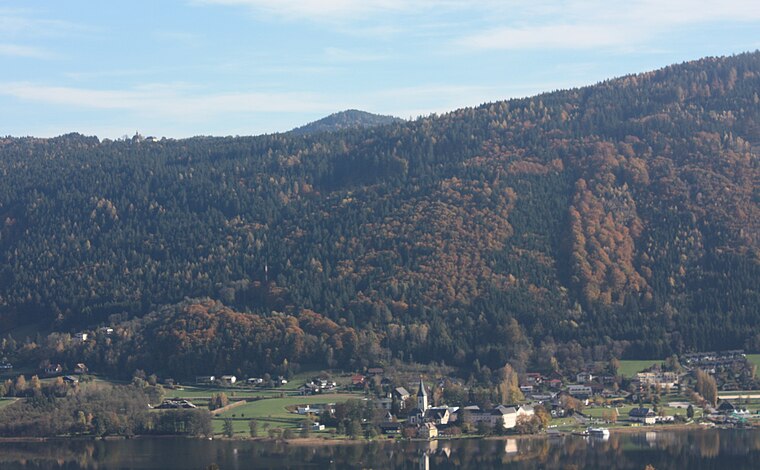
Photo: Mefusbren69, Public domain.
Ossiach is a municipality in the Feldkirchen District in the Austrian state of Carinthia. The small settlement is mainly known for Ossiach Abbey. Ossiach is situated 10 km southwest of Waiern Abzw Krankenhaus.
Waiern Abzw Krankenhaus
- Type: Bus stop
- Category: transportation
- Location: Feldkirchen in Kärnten, Feldkirchen District, Carinthia, Austria, Central Europe, Europe
- View on OpenStreetMap
Latitude
46.73175° or 46° 43′ 54″ northLongitude
14.08015° or 14° 4′ 49″ eastOpen location code
8FRPP3JJ+P3OpenStreetMap ID
node 5041741292OpenStreetMap feature
highway=bus_stopOpenStreetMap feature
public_transport=platform
This page is based on OpenStreetMap, Wikidata, and Wikimedia Commons.
We’d love your help improving our open data sources. Thank you for contributing.
Satellite Map
Discover Waiern Abzw Krankenhaus from above in high-definition satellite imagery.
Notable Places Nearby
Highlights include Evang. Friedhof Waiern and FF Waiern.
Nearby Places
Explore places such as Waiern Gasthaus Brandstätter and Waiern Abzw Krankenhaus.
Carinthia: Must-Visit Destinations
Delve into Klagenfurt, Villach, Wörthersee, and Spittal an der Drau.
Curious Bus Stops to Discover
Uncover intriguing bus stops from every corner of the globe.
About Mapcarta. Data © OpenStreetMap contributors and available under the Open Database License". Text is available under the CC BY-SA 4.0 license, except for photos, directions, and the map. Photo: Wikimedia, CC BY-SA 3.0.