Col du Sapet
Col du Sapet is in Florac Trois Rivières, Arrondissement of Florac, Occitanie and has an elevation of 1,080 metres. Col du Sapet is situated nearby to the village Saint-Julien-d’Arpaon, as well as near Fraissinet-de-Lozère.| Tap on a place to explore it |
Places of Interest Nearby
Highlights include Château de Grizac and Château de Saint-Julien-d’Arpaon.
Château de Grizac
Castle

Photo: Ancalagon, CC BY-SA 3.0.
Grizac Castle is located below the village of the same name, in Le Pont-de-Montvert commune of Lozère department, in the region of Occitanie, France. It was built in the middle of the 13th century and enlarged in the 14th century. Château de Grizac is situated 2 km northeast of Col du Sapet.
Château de Saint-Julien-d’Arpaon
Castle

Photo: Sanguinez, CC BY-SA 3.0.
Château de Saint-Julien-d’Arpaon is a castle, which is situated 3½ km southwest of Col du Sapet.
Places in the Area
Nearby places include Saint-Julien-d’Arpaon and Fraissinet-de-Lozère.
Saint-Julien-d’Arpaon
Village
Photo: Sanguinez, CC BY-SA 3.0.
Saint-Julien-d'Arpaon is a former commune in the Lozère department in southern France. On 1 January 2016, it was merged into the new commune of Cans-et-Cévennes. Saint-Julien-d’Arpaon is situated 3 km southwest of Col du Sapet.
Fraissinet-de-Lozère
Village
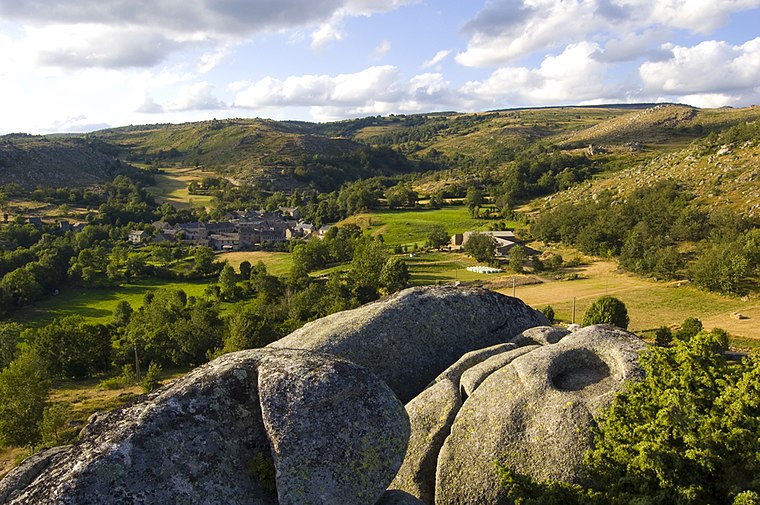
Photo: philippe baumgart, CC BY 2.0.
Fraissinet-de-Lozère is a former commune in the Lozère department in southern France. On 1 January 2016, it was merged into the new commune of Pont-de-Montvert-Sud-Mont-Lozère. Its population was 192 in 2019. Fraissinet-de-Lozère is situated 6 km north of Col du Sapet.
Cocurès
Village

Photo: Bastien.pierre, CC BY-SA 4.0.
Cocurès is a former commune in the Lozère department in southern France. On 1 January 2016, it was merged into the new commune of Bédouès-Cocurès. Cocurès is situated 6 km northwest of Col du Sapet.
Col du Sapet
- Type: Sign
- Categories: information and tourism
- Location: Florac Trois Rivières, Arrondissement of Florac, Lozère, Occitanie, France, Europe
- View on OpenStreetMap
Latitude
44.32528° or 44° 19′ 31″ northLongitude
3.68601° or 3° 41′ 10″ eastElevation
1,080 metres (3,543 feet)Open location code
8FP58MGP+4COpenStreetMap ID
node 5048948798OpenStreetMap feature
tourism=information
This page is based on OpenStreetMap, Wikidata, and Wikimedia Commons.
We’d love your help improving our open data sources. Thank you for contributing.
Satellite Map
Discover Col du Sapet from above in high-definition satellite imagery.
Places with the Same Name
Discover other places named “Col du Sapet”.
Notable Places Nearby
Highlights include Col du Sapet and Menhir du Col du Sapet.
Nearby Places
Explore places such as Pierrefort and Bergerie.
Occitanie: Must-Visit Destinations
Delve into Haute-Garonne, Toulouse, Montpellier, and Lot.
Curious Places to Discover
Uncover intriguing places from every corner of the globe.
About Mapcarta. Data © OpenStreetMap contributors and available under the Open Database License". Text is available under the CC BY-SA 4.0 license, except for photos, directions, and the map. Photo: Benh, CC BY-SA 3.0.