El Rey de la Tapa
El Rey de la Tapa is a bar in Ceutí, Murcia, Murcia. El Rey de la Tapa is situated nearby to the park Parque ‘Juan Carlos I’, as well as near the town hall Ayuntamiento de Ceutí.| Tap on a place to explore it |
Places of Interest Nearby
Highlights include Museo etnográfico Carlos Soriano.
Museo etnográfico Carlos Soriano
Museum

Photo: Natalia Mondéjar Rodríguez, CC BY-SA 4.0.
Museo etnográfico Carlos Soriano is a museum, which is situated 2½ km east of El Rey de la Tapa.
Places in the Area
Nearby places include Lorquí and Alguazas.
Lorquí
Town

Photo: Pedro J Pacheco, CC BY-SA 4.0.
Lorquí is a Spanish municipality in the autonomous community of Murcia. It has a population of 6,493 and an area of 15 km2.
Alguazas
Town
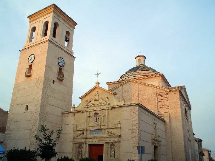
Photo: Julianalguazas, CC BY-SA 3.0.
Alguazas is a municipality of Spain in the autonomous community and province of Murcia and it is located in the south-west of the northeastern quarter. Alguazas is situated 4 km southeast of El Rey de la Tapa.
Archena
Town
Photo: Wikimedia, CC BY-SA 3.0.
Archena is a municipality in Spain in the province of Murcia and is located in the northeastern quarter. It has a population of 18,496 and an area of 16.5 km2. Archena is situated 5 km northwest of El Rey de la Tapa.
El Rey de la Tapa
- Type: Bar
- Location: Ceutí, Murcia, Murcia, Eastern Spain, Spain, Iberia, Europe
- View on OpenStreetMap
Latitude
38.07773° or 38° 4′ 40″ northLongitude
-1.27531° or 1° 16′ 31″ westOpen location code
8CCW3PHF+3VOpenStreetMap ID
node 5079571617OpenStreetMap feature
amenity=bar
This page is based on OpenStreetMap, Wikidata, and Wikimedia Commons.
We’d love your help improving our open data sources. Thank you for contributing.
Satellite Map
Discover El Rey de la Tapa from above in high-definition satellite imagery.
Places with the Same Name
Discover other places named “El Rey de la Tapa”.
Notable Places Nearby
Highlights include Parque ‘Juan Carlos I’ and Ayuntamiento de Ceutí.
Nearby Places
Explore places such as Reina Mariana and Testa.
Murcia: Must-Visit Destinations
Delve into Cartagena, Lorca, Caravaca de la Cruz, and La Manga.
Curious Bars to Discover
Uncover intriguing bars from every corner of the globe.
About Mapcarta. Data © OpenStreetMap contributors and available under the Open Database License". Text is available under the CC BY-SA 4.0 license, except for photos, directions, and the map. Photo: Tango7174, CC BY-SA 4.0.