Parc Naturel Régional de Corse
Parc Naturel Régional de Corse is a government office in Corte, Upper Corsica, Corsica which is located on Cours Paoli. Parc Naturel Régional de Corse is situated nearby to the government office Sous-Préfecture de Corte, as well as near the fountain Fontaine de Panate.| Tap on a place to explore it |
Places of Interest Nearby
Highlights include Chapelle Sainte-Croix de Corte and Annunciation Church.
Chapelle Sainte-Croix de Corte
Church

Photo: Pierre Bona, CC BY-SA 3.0.
Chapelle Sainte-Croix de Corte is a church, which is situated 440 metres south of Parc Naturel Régional de Corse.
Annunciation Church
Church

Photo: Wikimedia, CC BY-SA 2.0.
Annunciation Church is situated 640 metres south of Parc Naturel Régional de Corse.
Corte railway station
Railway station
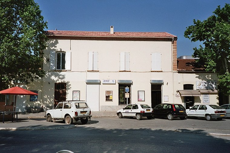
Photo: Wikimedia, CC BY-SA 3.0.
Corte railway station is situated 1 km southeast of Parc Naturel Régional de Corse.
Places in the Area
Nearby places include Santa-Lucia-di-Mercurio and Venaco.
Santa-Lucia-di-Mercurio
Village

Photo: Pierre Bona, CC BY-SA 3.0.
Santa-Lucia-di-Mercurio is a commune in the Haute-Corse department of France on the island of Corsica. Santa-Lucia-di-Mercurio is situated 6 km east of Parc Naturel Régional de Corse.
Venaco
Village

Photo: Pierre Bona, CC BY-SA 3.0.
Venaco is a commune in the Haute-Corse department of France on the island of Corsica. Venaco is situated 9 km south of Parc Naturel Régional de Corse.
Parc Naturel Régional de Corse
- Type: Government office
- Address: Cours Paoli
- Categories: office and government building
- Location: Corte, Arrondissement of Corte, Upper Corsica, Corsica, France, Europe
- View on OpenStreetMap
Latitude
42.31062° or 42° 18′ 38″ northLongitude
9.14978° or 9° 8′ 59″ eastOpen location code
8FJF846X+6WOpenStreetMap ID
node 5109367192OpenStreetMap feature
office=government
This page is based on OpenStreetMap, Wikidata, and Wikimedia Commons.
We’d love your help improving our open data sources. Thank you for contributing.
Satellite Map
Discover Parc Naturel Régional de Corse from above in high-definition satellite imagery.
Places with the Same Name
Discover other places named “Parc Naturel Régional de Corse”.
Notable Places Nearby
Highlights include Sous-Préfecture de Corte and Fontaine de Panate.
Nearby Places
Explore places such as Immeuble Le Cyrnos and Résidence Saint-Joseph Bat B.
Corsica: Must-Visit Destinations
Delve into Ajaccio, Bastia, Bonifacio, and Calvi.
Curious Government Offices to Discover
Uncover intriguing government offices from every corner of the globe.
About Mapcarta. Data © OpenStreetMap contributors and available under the Open Database License". Text is available under the CC BY-SA 4.0 license, except for photos, directions, and the map. Photo: KlausF, CC BY 3.0.