Hometrainer
Hometrainer is an outdoor gym in Pullach i.Isartal, Munich, Bavaria. Hometrainer is situated nearby to the outdoor gym Rücken, as well as near Klimmzug.| Tap on a place to explore it |
Places of Interest Nearby
Highlights include Grünwald Woodland Cemetery and Villa Bellemaison (Höllriegelskreuth).
Grünwald Woodland Cemetery
Cemetery

Photo: Bruno413, CC BY-SA 4.0.
Grünwald Woodland Cemetery is situated 510 metres southeast of Hometrainer.
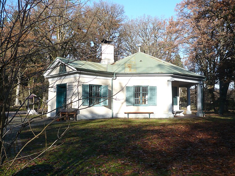
Villa Bellemaison (Höllriegelskreuth)
Historic building

Photo: GFreihalter, CC BY-SA 3.0.
Villa Bellemaison (Höllriegelskreuth) is a historic building, which is situated 1 km northwest of Hometrainer.
Grünwald Castle
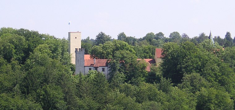
Photo: Wikimedia, CC BY-SA 3.0.
Grünwald Castle is a medieval hill castle in Grünwald, Bavaria. Grünwald Castle is situated 1¼ km north of Hometrainer.
Places in the Area
Nearby places include Sauschütt and Höllriegelskreuth.


Hometrainer
- Type: Outdoor gym
- Categories: athletics, recreation area, and sports location
- Location: Pullach i.Isartal, Munich, Upper Bavaria, Bavaria, Germany, Central Europe, Europe
- View on OpenStreetMap
Latitude
48.03262° or 48° 1′ 57″ northLongitude
11.51672° or 11° 31′ 0″ eastOpen location code
8FWH2GM8+2MOpenStreetMap ID
node 5178723817OpenStreetMap feature
leisure=fitness_stationOpenStreetMap feature
sport=athletics
This page is based on OpenStreetMap, Wikidata, and Wikimedia Commons.
We’d love your help improving our open data sources. Thank you for contributing.
Satellite Map
Discover Hometrainer from above in high-definition satellite imagery.
Notable Places Nearby
Highlights include Rücken and Klimmzug.
Nearby Places
Explore places such as Zugang Ostseite and Zugang Westseite.
Upper Bavaria: Must-Visit Destinations
Delve into Munich, Ingolstadt, Rosenheim, and Dachau.
Curious Outdoor Gyms to Discover
Uncover intriguing outdoor gyms from every corner of the globe.
About Mapcarta. Data © OpenStreetMap contributors and available under the Open Database License". Text is available under the CC BY-SA 4.0 license, except for photos, directions, and the map. Photo: Aconcagua, CC BY-SA 3.0.