Frankey’s Diner
Frankey’s Diner is a restaurant in City of Cape Town, Western Cape. Frankey’s Diner is situated nearby to Sea Point Methodist Church, as well as near Olaf’s Guest House.| Tap on a place to explore it |
Places of Interest Nearby
Highlights include Cape Town Stadium and Sea Point High School.
Cape Town Stadium
Stadium
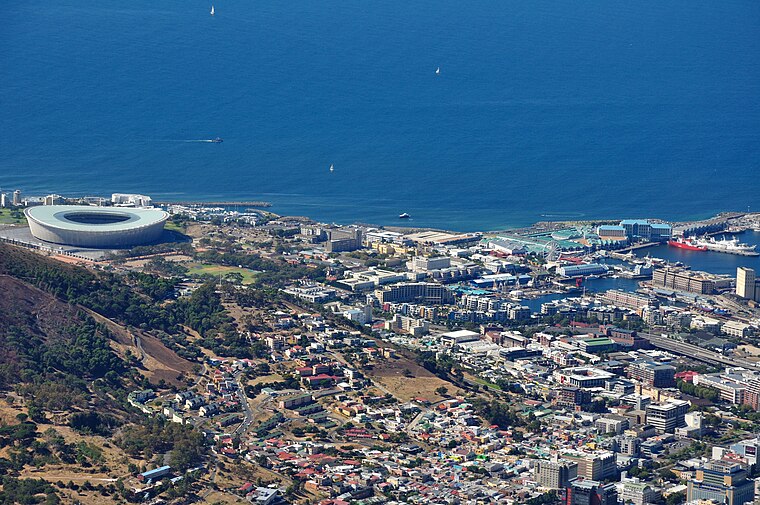
Photo: Wikimedia, CC BY-SA 3.0.
The Cape Town Stadium is an association football and rugby union stadium in Cape Town, South Africa, that was built as part of the country's hosting of the 2010 FIFA World Cup. Cape Town Stadium is situated 2 km northeast of Frankey’s Diner.
Sea Point High School
School
Sea Point High School, formerly Sea Point Boys' High School, is a co-educational public high school in Main Road, Sea Point, Cape Town, South Africa. The school was established on 21 April 1884. Sea Point High School is situated 170 metres north of Frankey’s Diner.
Signal Hill
Peak

Photo: Zaian, Public domain.
Signal Hill, or Lion's Rump, is a landmark flat-topped hill located in Cape Town, next to Lion's Head and Table Mountain. The hill was also known as "The Lion's Flank", a term now obsolete. Together with Lion's Head, Signal Hill looks like a lion sphinx.
Places in the Area
Nearby places include Mouille Point and Schotsche Kloof.
Mouille Point
Suburb

Photo: Hilton1949, CC BY-SA 3.0.
Mouille Point is an affluent suburb of Cape Town, situated between the Victoria and Alfred Waterfront and Granger Bay to the east, Green Point to the south and the Atlantic Ocean to the north and west.
Schotsche Kloof
Suburb
The Bo-Kaap is an area of Cape Town, South Africa formerly known as the Malay Quarter. It is a former racially segregated area, situated on the slopes of Signal Hill above the city centre and is a historical centre of Cape Malay culture in Cape Town.
V&A Waterfront
Suburb

Photo: Damien du Toit, CC BY 2.0.
The V&A Waterfront, often referred to as The Waterfront and The V&A, is a mixed-use suburb in Cape Town, South Africa, featuring upmarket residential apartments, a major shopping mall, a marina, and multiple large hotels. V&A Waterfront is situated 3 km east of Frankey’s Diner.
Frankey’s Diner
- Type: Restaurant
- Wheelchair access: yes
- Category: food
- Location: City of Cape Town, Western Cape, South Africa, Southern Africa, Africa
- View on OpenStreetMap
Latitude
-33.91195° or 33° 54′ 43″ southLongitude
18.39308° or 18° 23′ 35″ eastOpen location code
4FRW39QV+66OpenStreetMap ID
node 5204809623OpenStreetMap feature
amenity=restaurantOpenStreetMap attribute
wheelchair=yes
This page is based on OpenStreetMap, Wikidata, and Wikimedia Commons.
We’d love your help improving our open data sources. Thank you for contributing.
Satellite Map
Discover Frankey’s Diner from above in high-definition satellite imagery.
Notable Places Nearby
Highlights include Sea Point Methodist Church and Olaf’s Guest House.
Nearby Places
Explore places such as Kateznailbar and Hotel 303 Sea Point.
Western Cape: Must-Visit Destinations
Delve into Cape Town, Robben Island, Stellenbosch, and Paarl.
Curious Restaurants to Discover
Uncover intriguing restaurants from every corner of the globe.
About Mapcarta. Data © OpenStreetMap contributors and available under the Open Database License". Text is available under the CC BY-SA 4.0 license, except for photos, directions, and the map. Photo: Wikimedia, CC BY-SA 3.0.