Bar Tatono
Bar Tatono is a bar in Las Palmas, Gran Canaria. Bar Tatono is situated nearby to Adrián García Armas, as well as near the church Iglesia de pentencostal.| Tap on a place to explore it |
Places of Interest Nearby
Highlights include beach de Las Alcaravaneras and Plaza de España.
Plaza de España
Garden

Photo: Matti Mattila, CC BY-SA 2.0.
Plaza de España is a garden, which is situated 430 metres north of Bar Tatono.
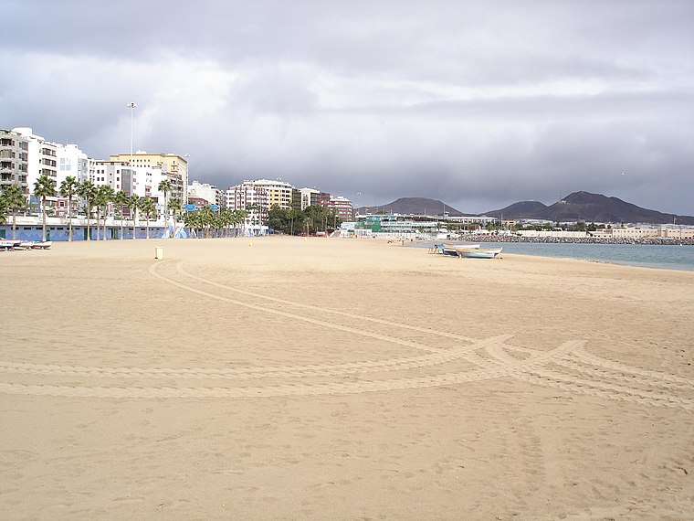
beach de Las Canteras
Beach

Photo: Bengt Nyman, CC BY 2.0.
The Playa de Las Canteras is the main urban beach of the city of Las Palmas de Gran Canaria, one of the most important beaches of the Canary Islands. Las Canteras has an Environmental Management System certified according to the UNE-EN ISO 14001 norm and a Universal Accessibility Certificate for bathing services for people with reduced mobility, certified by the same organization.
Places in the Area
Nearby places include Ciudad Jardín and La Isleta.

La Isleta
Suburb

Photo: Gino maccanti, CC BY 2.0.
La Isleta is a suburb, which is situated 2½ km north of Bar Tatono.
La Feria del Atlántico
Suburb
 La Feria del Atlántico is a suburb, which is situated 2½ km southwest of Bar Tatono.
Bar Tatono
- Type: Bar
- Location: Las Palmas, Las Palmas, Gran Canaria, Canary Islands, Spain, Iberia, Europe
- View on OpenStreetMap
Latitude
28.13074° or 28° 7′ 51″ northLongitude
-15.4339° or 15° 26′ 2″ westOpen location code
7CW64HJ8+7COpenStreetMap ID
node 5206553476OpenStreetMap feature
amenity=bar
This page is based on OpenStreetMap, Wikidata, and Wikimedia Commons.
We’d love your help improving our open data sources. Thank you for contributing.
Satellite Map
Discover Bar Tatono from above in high-definition satellite imagery.
Notable Places Nearby
Highlights include Adrián García Armas and Iglesia de pentencostal.
Nearby Places
Explore places such as Pizza Real and Tienda Colchones Outlet Española del Descanso.
Gran Canaria: Must-Visit Destinations
Delve into Telde, Ingenio, Maspalomas, and Playa del Inglés.
Curious Bars to Discover
Uncover intriguing bars from every corner of the globe.
About Mapcarta. Data © OpenStreetMap contributors and available under the Open Database License". Text is available under the CC BY-SA 4.0 license, except for photos, directions, and the map. Photo: Gino maccanti, CC BY 2.0.