Semmelweis Klinikák metro station
Semmelweis Klinikák is a station on the M3 line of the Budapest Metro. It opened on December 31, 1976, as one of the initial six stations of the line, between Deák Ferenc tér and Nagyvárad tér.| Tap on a place to explore it |
Photo: Bilykralik16, CC BY-SA 4.0.
- Type: Metro station
- Description: Budapest metro station
- Also known as: “Klinikak”, “Klinikák”, and “Semmelweis Klinikák”
- Wheelchair access: yes
Places of Interest Nearby
Highlights include Perpetual Adoration Church, Budapest and Holocaust Memorial Center.
Perpetual Adoration Church, Budapest
Church

Photo: József Rozsnyai, CC BY-SA 3.0.
Perpetual Adoration Church, Budapest is situated 120 metres west of Semmelweis Klinikák metro station.
Holocaust Memorial Center
Museum

Photo: VinceB, CC BY-SA 3.0.
The Holocaust Memorial Center is a Jewish Holocaust history museum, located at 39 Páva Utca, Budapest, in Hungary. Situated in the grounds of the former Páva Street Synagogue, completed in the 1920s, the museum serves as a memorial for and about Hungarian Jews who were murdered in the Holocaust. Holocaust Memorial Center is situated 330 metres west of Semmelweis Klinikák metro station.
Hungarian Natural History Museum
Museum
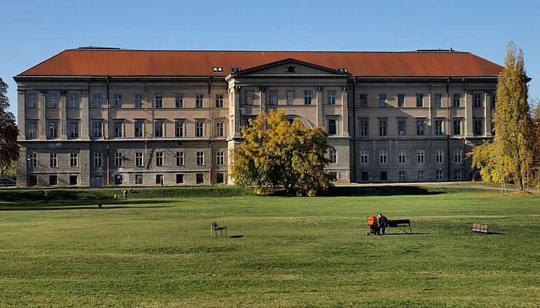
Photo: Misibacsi, CC BY-SA 3.0.
The Hungarian Natural History Museum in Budapest, dating back to 1802, houses the largest natural history collections of Hungary and the region. Hungarian Natural History Museum is situated 580 metres east of Semmelweis Klinikák metro station.
Places in the Area
Nearby places include Józsefváros and Budapest’s Palace District.
Józsefváros
 Józsefváros is the traditional name of the VIII. district, literally meaning "Josephtown" and referring to Emperor Joseph II of Austria and Hungary. This area is popular, with scores of students and several cafés and pizzerias.
Budapest’s Palace District
Suburb
Budapest's Palotanegyed forms an inner part of Pest, the eastern half of Budapest. Known until the communist period as the ‘Magnates’ Quarter’, it consists of the most westerly part of the city's Eighth District, or Józsefváros, which was named on 7 November 1777 after Joseph II, Holy Roman Emperor and Archduke of Austria, who reigned 1765-1790.

Semmelweis Klinikák metro station
- Categories: underground station, railway station, station, and transportation
- Location: Pest County, Central Hungary, Hungary, Central Europe, Europe
- View on OpenStreetMap
Latitude
47.48326° or 47° 28′ 60″ northLongitude
19.07792° or 19° 4′ 41″ eastOperator
BKVOpen location code
8FVXF3MH+85OpenStreetMap ID
node 5217774772OpenStreetMap feature
public_transport=stationOpenStreetMap feature
railway=stationOpenStreetMap attribute
wheelchair=yesWikidata ID
Q2633721
This page is based on OpenStreetMap, Wikidata, Wikimedia Commons, and Wikipedia.
We’d love your help improving our open data sources. Thank you for contributing.
Satellite Map
Discover Semmelweis Klinikák metro station from above in high-definition satellite imagery.
In Other Languages
From Czech to Ukrainian—“Semmelweis Klinikák metro station” goes by many names.
- Czech: “Klinikák”
- Czech: “Semmelweis Klinikák”
- Dutch: “Klinikák”
- Dutch: “Semmelweis klinikák”
- Esperanto: “Klinikák”
- Esperanto: “Semmelweis klinikák”
- Esperanto: “Semmelweis Klinikák”
- Finnish: “Klinikákin metroasema”
- Finnish: “Semmelweis Klinikákin metroasema”
- French: “Klinikák”
- French: “Semmelweis klinikák”
- French: “Semmelweis Klinikák”
- Georgian: “ზემელვაის-კლინიკაკი”
- Georgian: “კლინიკაკი”
- German: “Klinikák”
- German: “Semmelweis Klinikák”
- Hungarian: “Klinikák”
- Hungarian: “Semmelweis Klinikák metróállomás”
- Hungarian: “Semmelweis Klinikák”
- Italian: “stazione di Semmelweis Klinikák”
- Japanese: “クリニカーク駅”
- Polish: “Klinikák”
- Polish: “Semmelweis klinikák”
- Polish: “Semmelweis Klinikák”
- Russian: “Земмельвайс клиникак”
- Russian: “Клиникак”
- Ukrainian: “Клінікак”
Notable Places Nearby
Highlights include Salkaházi Sára park and Fül-Orr-Gégészeti és Fej-Nyaksebészeti Klinika.
Nearby Places
Explore places such as Szuper Diszkont and Telepocak Étkezde.
Pest County: Must-Visit Destinations
Delve into Érd, Cegléd, Gödöllő, and Budaörs.
Curious Metro Stations to Discover
Uncover intriguing metro stations from every corner of the globe.
About Mapcarta. Data © OpenStreetMap contributors and available under the Open Database License". Text is available under the CC BY-SA 4.0 license, except for photos, directions, and the map. Description text is based on the Wikipedia page “Semmelweis Klinikák metro station”. Photo: Bilykralik16, CC BY-SA 4.0.