Karoliininvuori
Karoliininvuori is a peak in Uusimaa, Southern Finland and has an elevation of 29 metres. Karoliininvuori is situated nearby to the quarter Jollas, as well as near the hamlet Villinki.| Tap on a place to explore it |
Places of Interest
Highlights include National Defence University and Degerö Manor.
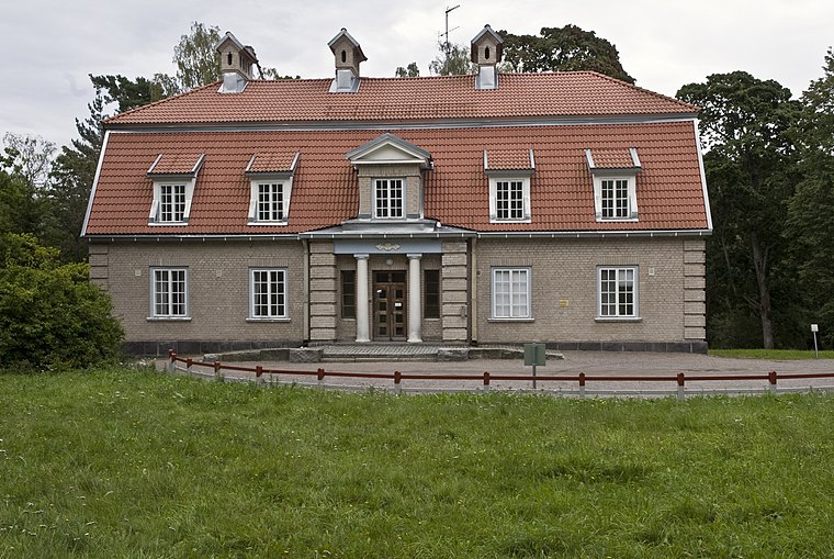
National Defence University
University

Photo: Wikimedia, Public domain.
The Finnish National Defence University is a military university located in Helsinki. The university trains officers for the Finnish Defence Forces and the Finnish Border Guard.

Places in the Area
Nearby places include Eastern suburbs and Herttoniemi.
Eastern suburbs
 East Helsinki is an area in Helsinki, Finland, usually thought to comprise the city's eastern and south-eastern major districts, including the districts of Vartiokylä, Myllypuro, Mellunkylä, Vuosaari, Herttoniemi, Laajasalo and Kulosaari.
Herttoniemi
Suburb

Photo: Ximonic, CC BY-SA 4.0.
Herttoniemi is an East Helsinki neighbourhood and a suburb of Helsinki, the Finnish capital.
Vuosaari
Suburb

Photo: Olli hki, CC BY-SA 3.0.
Vuosaari is a neighbourhood in the city of Helsinki, Finland. It is located by the sea in East Helsinki and with its area of 15.38 km2 is geographically the largest district in the city.
Karoliininvuori
- Type: Peak with an elevation of 29 metres
- Category: landform
- Location: Uusimaa, Southern Finland, Finland, Nordic countries, Europe
- View on OpenStreetMap
Latitude
60.1626° or 60° 9′ 46″ northLongitude
25.0923° or 25° 5′ 32″ eastElevation
29 metres (95 feet)Open location code
9GG7537R+3WOpenStreetMap ID
node 5223182817OpenStreetMap feature
natural=peak
This page is based on OpenStreetMap, Wikidata, and Wikimedia Commons.
We’d love your help improving our open data sources. Thank you for contributing.
Satellite Map
Discover Karoliininvuori from above in high-definition satellite imagery.
In Other Languages
From Finnish to Swedish—“Karoliininvuori” goes by many names.
- Finnish: “Karoliininvuori”
- Swedish: “Karolinberget”
Localities in the Area
Explore places such as Jollas and Villinki.
Notable Places Nearby
Highlights include Giant’s Kettle and Regina von Emmeritzin puisto.
Uusimaa: Must-Visit Destinations
Delve into Helsinki, Espoo, Vantaa, and Porvoo.
Curious Peaks to Discover
Uncover intriguing peaks from every corner of the globe.
About Mapcarta. Data © OpenStreetMap contributors and available under the Open Database License". Text is available under the CC BY-SA 4.0 license, except for photos, directions, and the map. Photo: Danapit, CC BY-SA 3.0.