アオキスーパー 朝宮店
アオキスーパー 朝宮店 is a supermarket in Kasugai, Aichi. アオキスーパー 朝宮店 is situated nearby to the park 御殿公園, as well as near 上ノ場公園.| Tap on a place to explore it |
Places of Interest Nearby
Highlights include Kasugai Station and Kasugai City Library.
Kasugai Station
Railway station
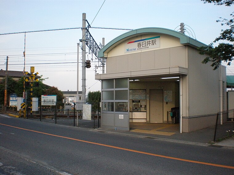
Photo: KKPCW, CC BY-SA 3.0.
Kasugai Station is a railway station in the city of Kasugai, Aichi Prefecture, Japan, operated by Meitetsu. Kasugai Station is situated 2 km west of アオキスーパー 朝宮店.
Kasugai City Library
Library

Photo: Asturio Cantabrio, CC BY-SA 4.0.
Kasugai City Library is situated 1½ km east of アオキスーパー 朝宮店.
Kasugai Police Station
Police station
 Kasugai Police Station is situated 1¼ km northeast of アオキスーパー 朝宮店.
Places in the Area
Nearby places include Kusunoki 3-chome and Toyoyama.
Kusunoki 3-chome
Neighborhood
Photo: 円周率3パーセント, CC BY-SA 4.0.
Kusunoki 3-chome is a neighborhood, which is situated 4 km southwest of アオキスーパー 朝宮店.
Toyoyama
Town

Photo: Tmv, CC BY-SA 4.0.
Toyoyama is a town located in Nishikasugai District, Aichi Prefecture, Japan. As of 1 October 2019, the town had an estimated population of 15,630 in 6,757 households, and a population density of 2,529 persons per km2. Toyoyama is situated 4 km west of アオキスーパー 朝宮店.
Moriyama-ku
Suburb

Photo: Bariston, CC BY-SA 3.0.
Moriyama is one of the wards of the city of Nagoya in Aichi Prefecture, Japan. As of 1 October 2019, the ward has an estimated population of 176,298 and a population density of 5,184 inhabitants per square kilometre. The total area is 34.01 km2. Moriyama-ku is situated 5 km south of アオキスーパー 朝宮店.
アオキスーパー 朝宮店
- Type: Supermarket
- Categories: shop and food
- Location: Kasugai, Aichi, Chubu, Japan, East Asia, Asia
- View on OpenStreetMap
Latitude
35.24926° or 35° 14′ 57″ northLongitude
136.95798° or 136° 57′ 29″ eastBranch
朝宮店Open location code
8Q7R6XX5+P5OpenStreetMap ID
node 5236185923OpenStreetMap feature
shop=supermarket
This page is based on OpenStreetMap, Wikidata, and Wikimedia Commons.
We’d love your help improving our open data sources. Thank you for contributing.
Satellite Map
Discover アオキスーパー 朝宮店 from above in high-definition satellite imagery.
Notable Places Nearby
Highlights include 御殿公園 and 上ノ場公園.
Nearby Places
Explore places such as 朝宮薬局 and 天使みつばち幼稚園.
Aichi: Must-Visit Destinations
Delve into Nagoya, Toyota, Toyohashi, and Okazaki.
Curious Supermarkets to Discover
Uncover intriguing supermarkets from every corner of the globe.
About Mapcarta. Data © OpenStreetMap contributors and available under the Open Database License". Text is available under the CC BY-SA 4.0 license, except for photos, directions, and the map. Photo: Alpsdake, CC BY-SA 3.0.