Brettachmühle
Brettachmühle is a dwelling in Rot am See, Schwäbisch Hall, Baden-Württemberg. Brettachmühle is situated nearby to the cemetery Friedhof Hilgartshausen, as well as near the forest Rohrbachwald.| Tap on a place to explore it |
Places of Interest Nearby
Highlights include St. Peter und Paul and Bahnhof Rot am See.
St. Peter und Paul
Church

Photo: Ecelan, CC BY-SA 4.0.
St. Peter und Paul is a church, which is situated 2½ km northeast of Brettachmühle.
Bahnhof Rot am See
Railway station
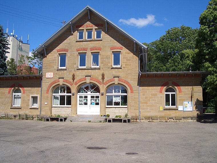
Photo: Hokemo TV, CC BY-SA 3.0.
Bahnhof Rot am See is a railway station, which is situated 3 km southwest of Brettachmühle.
Jakobskirche
Church

Photo: Wikimedia, CC BY-SA 1.0.
Jakobskirche is a church, which is situated 3½ km south of Brettachmühle.
Places in the Area
Nearby places include Gammesfeld and Wallhausen.
Wallhausen
Village

Photo: Wikimedia, CC BY-SA 1.0.
Wallhausen is a municipality in the district of Schwäbisch Hall in Baden-Württemberg in Germany. It contained the village of Hengstfeld and its hamlets of Asbach, Roßbürg and Schönbronn, incorporated into Wallhausen on 1 July 1974. Wallhausen is situated 6 km south of Brettachmühle.
Blaufelden
Village
 Blaufelden is a municipality in the district of Schwäbisch Hall in Baden-Württemberg in Germany. The settlement is first mentioned in a document from 1157. The Reformation was introduced to Blaufelden in 1526 and it has been Lutheran ever since. Blaufelden is situated 7 km northwest of Brettachmühle.
Brettachmühle
- Type: Dwelling
- Categories: locality, residential building, and building
- Location: Rot am See, Schwäbisch Hall, Stuttgart, Baden-Württemberg, Germany, Central Europe, Europe
- View on OpenStreetMap
Latitude
49.26406° or 49° 15′ 51″ northLongitude
10.06395° or 10° 3′ 50″ eastOpen location code
8FXG7377+JHOpenStreetMap ID
node 5240991393OpenStreetMap feature
place=isolated_dwelling
This page is based on OpenStreetMap, Wikidata, and Wikimedia Commons.
We’d love your help improving our open data sources. Thank you for contributing.
Satellite Map
Discover Brettachmühle from above in high-definition satellite imagery.
Notable Places Nearby
Highlights include Friedhof Hilgartshausen and Rohrbachwald.
Nearby Places
Explore places such as Hilgartshausen Mühlweg and Hilgartshausen.
Baden-Württemberg: Must-Visit Destinations
Delve into Stuttgart, Heidelberg, Karlsruhe, and Mannheim.
Curious Dwellings to Discover
Uncover intriguing dwellings from every corner of the globe.
About Mapcarta. Data © OpenStreetMap contributors and available under the Open Database License". Text is available under the CC BY-SA 4.0 license, except for photos, directions, and the map. Photo: Traveler100, CC BY-SA 3.0.