Ancien poste du 12e siècle
Ancien poste du 12e siècle is a historic building in Cloyes-les-Trois-Rivières, Arrondissement of Châteaudun, Centre-Val de Loire. Ancien poste du 12e siècle is situated nearby to the town hall Mairie déléguée de Montigny-le-Gannelon, as well as near the church Église Saint-Sauveur-Saint-Gilles de Montigny-le-Gannelon.| Tap on a place to explore it |
Places of Interest Nearby
Highlights include Château de Montigny-le-Gannelon and Église Saint-Sauveur-Saint-Gilles de Montigny-le-Gannelon.
Château de Montigny-le-Gannelon
Castle

Photo: Manfred Heyde, CC BY-SA 3.0.
Château de Montigny-le-Gannelon is a castle, which is situated 180 metres south of Ancien poste du 12e siècle.
Église Saint-Sauveur-Saint-Gilles de Montigny-le-Gannelon
Church
 Église Saint-Sauveur-Saint-Gilles de Montigny-le-Gannelon is a church, which is situated 170 metres west of Ancien poste du 12e siècle.
Église Saint-Georges de Cloyes-sur-le-Loir
Church

Photo: Selbymay, CC BY-SA 3.0.
Église Saint-Georges de Cloyes-sur-le-Loir is a church, which is situated 2 km south of Ancien poste du 12e siècle.
Places in the Area
Nearby places include Villebout and Châteaudun.
Villebout
Village
Villebout is a commune in the Loir-et-Cher department in central France. Villebout is situated 5 km southwest of Ancien poste du 12e siècle.
Châteaudun
Town
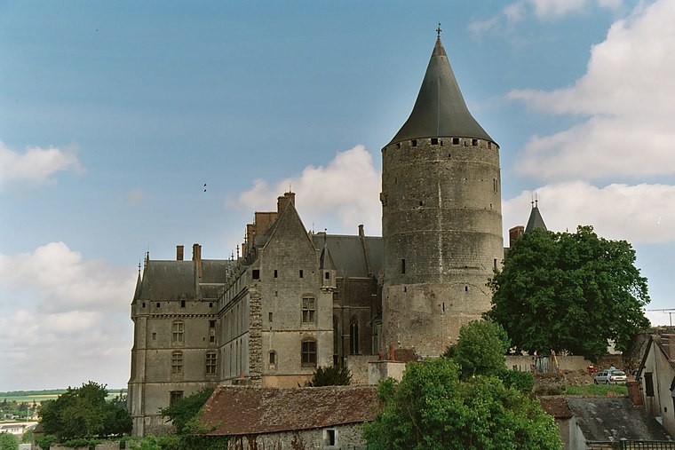
Photo: Calips, CC BY-SA 3.0.
Châteaudun is a commune in the Eure-et-Loir department in northern France. It is a sub-prefecture of the department. It was the site of the Battle of Châteaudun during the Franco-Prussian War. Châteaudun is situated 9 km northeast of Ancien poste du 12e siècle.
Ancien poste du 12e siècle
- Type: Historic building
- Categories: post office, historic site, tourist attraction, and tourism
- Location: Cloyes-les-Trois-Rivières, Arrondissement of Châteaudun, Eure-et-Loir, Centre-Val de Loire, France, Europe
- View on OpenStreetMap
Latitude
48.01402° or 48° 0′ 51″ northLongitude
1.23538° or 1° 14′ 7″ eastInception
12th centuryOpen location code
8FW3267P+J5OpenStreetMap ID
node 5243100034OpenStreetMap feature
historic=buildingWikidata ID
Q22940837
This page is based on OpenStreetMap, Wikidata, and Wikimedia Commons.
We’d love your help improving our open data sources. Thank you for contributing.
Satellite Map
Discover Ancien poste du 12e siècle from above in high-definition satellite imagery.
In Other Languages
“Ancien poste du 12e siècle” goes by many names.
- French: “ancien poste du 12e siècle”
- French: “Ancien poste du 12e siècle”
Notable Places Nearby
Highlights include Mairie déléguée de Montigny-le-Gannelon and Centre Nautique des 3 Rivières.
Nearby Places
Explore places such as Le Relais de Montigny and Manège.
Centre-Val de Loire: Must-Visit Destinations
Delve into Orléans, Tours, Chartres, and Bourges.
Curious Historic Buildings to Discover
Uncover intriguing historic buildings from every corner of the globe.
About Mapcarta. Data © OpenStreetMap contributors and available under the Open Database License". Text is available under the CC BY-SA 4.0 license, except for photos, directions, and the map. Photo: Havang(nl), CC0.