Schopflenberg
Schopflenberg is a peak in Göppingen, Stuttgart, Baden-Württemberg and has an elevation of 400 metres. Schopflenberg is situated nearby to the village Bezgenriet, as well as near the locality Herdwiesen.| Tap on a place to explore it |
Places of Interest
Highlights include Jüdisches Museum Göppingen and Schloss Liebenstein.


Göppingen-Bezgenriet airfield
Aerodrome
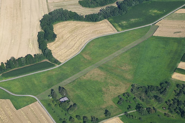
Photo: Carsten Steger, CC BY-SA 4.0.
Göppingen-Bezgenriet airfield is an aerodrome.
Places in the Area
Nearby places include Uhingen and Zell unter Aichelberg.
Uhingen
Town

Photo: Wikimedia, CC BY-SA 3.0.
Uhingen is a town in the district of Göppingen in Baden-Württemberg in southern Germany.
Zell unter Aichelberg
Village

Photo: LkGoeppingen, Public domain.
Zell unter Aichelberg is a municipality in the district of Göppingen in Baden-Württemberg in southern Germany.
Aichelberg
Village
Aichelberg is a municipality in the district of Göppingen in Baden-Württemberg in southern Germany. Aichelberg is between Stuttgart and Ulm at the Albaufstieg, the slope of the Swabian Jura in 357–615 meters altitude.
Schopflenberg
- Type: Peak with an elevation of 400 metres
- Category: landform
- Location: Göppingen, Stuttgart, Baden-Württemberg, Germany, Central Europe, Europe
- View on OpenStreetMap
Latitude
48.6732° or 48° 40′ 23″ northLongitude
9.5989° or 9° 35′ 56″ eastElevation
400 metres (1,312 feet)Open location code
8FWFMHFX+7GOpenStreetMap ID
node 5272796691OpenStreetMap feature
natural=peak
This page is based on OpenStreetMap, Wikidata, and Wikimedia Commons.
We’d love your help improving our open data sources. Thank you for contributing.
Satellite Map
Discover Schopflenberg from above in high-definition satellite imagery.
Localities in the Area
Explore places such as Schopflenberg and Bezgenriet.
Notable Places Nearby
Highlights include Quellteich and Herz-Jesu-Kirche.
Baden-Württemberg: Must-Visit Destinations
Delve into Stuttgart, Heidelberg, Karlsruhe, and Mannheim.
Curious Peaks to Discover
Uncover intriguing peaks from every corner of the globe.
About Mapcarta. Data © OpenStreetMap contributors and available under the Open Database License". Text is available under the CC BY-SA 4.0 license, except for photos, directions, and the map. Photo: Traveler100, CC BY-SA 3.0.