Streetchurch
Streetchurch is a social service facility in Zurich, Canton of Zurich which is located on Badenerstrasse. Streetchurch is situated nearby to the work of art Frau 1928, as well as near the health club Zen Move.| Tap on a place to explore it |
- Opening hours:
Monday—Friday: 8:30 AM—noon and 1:30 PM—5:00 PM
public holidays: closed - Type: Social service facility
- Address: Badenerstrasse 69, Zürich, 8004
- Wheelchair access: limited
Places of Interest Nearby
Highlights include Kino Xenix and St. Peter und Paul.
Kino Xenix
Movie theater
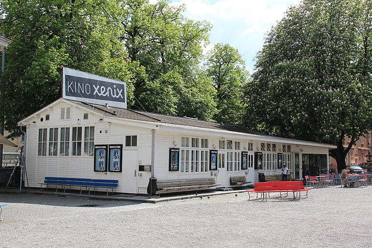
Photo: Muvibuff, CC BY-SA 3.0.
Kino Xenix is a movie theater, which is situated 200 metres north of Streetchurch.
St. Peter und Paul
Church

Photo: Ikiwaner, CC BY-SA 3.0.
St. Peter und Paul is a church, which is situated 160 metres southeast of Streetchurch.
Zurich Wiedikon railway station
Railway station

Photo: Paebi, CC BY-SA 3.0.
Zürich Wiedikon railway station is a railway station on the Zurich S-Bahn system in Wiedikon in the western part of the Swiss city of Zurich. The station is located within fare zone 110 of the Zürcher Verkehrsverbund. and served by S-Bahn trains on the Lake Zürich left bank line approaching the city from the south and south-east directions. Zurich Wiedikon railway station is situated 350 metres southwest of Streetchurch.
Places in the Area
Nearby places include Aussersihl and Alt-Wiedikon.
Aussersihl
Suburb

Photo: Roland zh, CC BY-SA 3.0.
Aussersihl is a district in the Swiss city of Zürich. Known officially as District number 4, the district is known as colloquially Chreis Cheib, cheib being the Zürich German word for an animal cadaver.
Alt-Wiedikon
Quarter
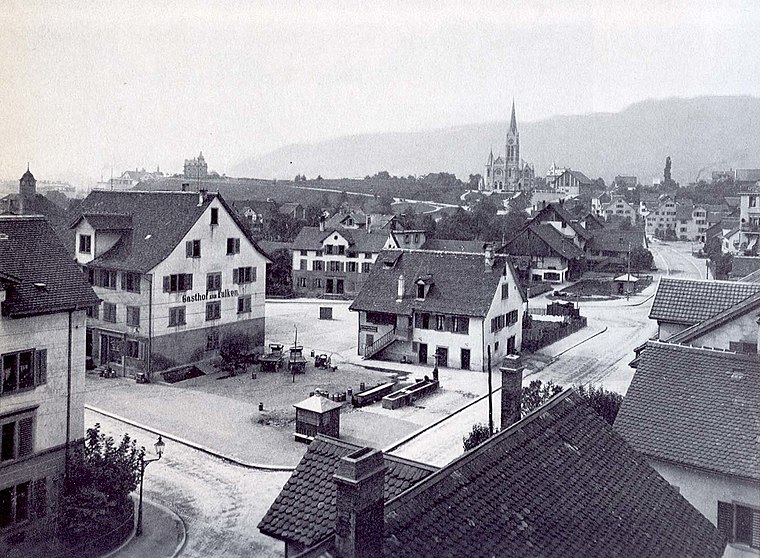
Photo: Wikimedia, Public domain.
Alt-Wiedikon is a quarter in the district 3 of Zürich. It was formerly a part of Wiedikon municipality, which was incorporated into Zürich in 1893. The quarter has a population of 14,971 distributed on an area of 1.85 km2.
Schipfe
Locality

Photo: Roland zh, CC BY-SA 3.0.
Schipfe is a residential district in Zurich, Switzerland, located on the eastern slope of the Lindenhof, one of the oldest parts of the Helvetii Oppidum Zurich-Lindenhof, by the river Limmat.
Streetchurch
Latitude
47.3735° or 47° 22′ 25″ northLongitude
8.52691° or 8° 31′ 37″ eastOpen location code
8FVC9GFG+9QOpenStreetMap ID
node 5277869461OpenStreetMap feature
amenity=social_facilityOpenStreetMap attribute
wheelchair=limited
This page is based on OpenStreetMap, Wikidata, and Wikimedia Commons.
We’d love your help improving our open data sources. Thank you for contributing.
Satellite Map
Discover Streetchurch from above in high-definition satellite imagery.
Notable Places Nearby
Highlights include Zen Move and Frau 1928.
Nearby Places
Explore places such as musik & form and Streetchurch.
Zurich: Must-Visit Destinations
Delve into Winterthur, Aarau, Zug, and Zurich Airport.
Curious Social Service Facilities to Discover
Uncover intriguing social service facilities from every corner of the globe.
About Mapcarta. Data © OpenStreetMap contributors and available under the Open Database License". Text is available under the CC BY-SA 4.0 license, except for photos, directions, and the map. Photo: ויקיג’אנקי, CC BY-SA 4.0.