Country del Pilar
Country del Pilar is a neighborhood in Lules Department, Tucumán. Country del Pilar is situated nearby to the neighborhood Country Loma Tenis, as well as near Barrio Araujo.| Tap on a place to explore it |
Places in the Area
Nearby places include Yerba Buena and Villa Nougués.
Yerba Buena
Town
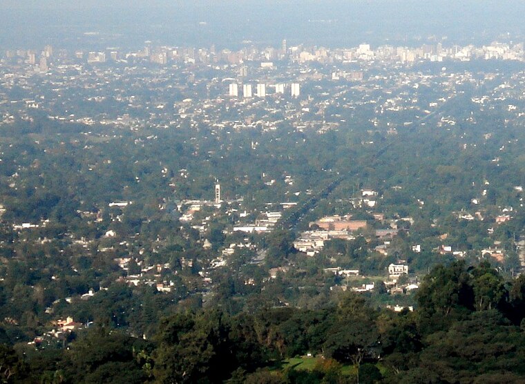
Photo: Jlazarte, Public domain.
Yerba Buena is the capital of the Yerba Buena Department in the province of Tucumán, Argentina. It is located at an altitude of around 466 metres. The city of Yerba Buena is the most urbanized area of the department. Yerba Buena is situated 3 km north of Country del Pilar.
Villa Nougués
Hamlet

Photo: Jlazarte, Public domain.
Villa Nougués is a settlement in Lules Department, Tucumán Province, in northern Argentina. Villa Nougués is situated 8 km west of Country del Pilar.
San Miguel de Tucumán

Photo: Fjturban, CC BY-SA 3.0.
San Miguel de Tucumán, usually known simply as Tucumán, is the capital city of Tucumán Province, and the largest city in the Northwest region of Argentina, with 606,000 people in the urban area.
Country del Pilar
- Type: Neighborhood
- Category: locality
- Location: Lules Department, Tucumán, Andean Northwest, Argentina, South America
- View on OpenStreetMap
Latitude
-26.83825° or 26° 50′ 18″ southLongitude
-65.30322° or 65° 18′ 12″ westOpen location code
575P5M6W+PPOpenStreetMap ID
node 5290402370OpenStreetMap feature
place=neighbourhood
This page is based on OpenStreetMap, Wikidata, and Wikimedia Commons.
We’d love your help improving our open data sources. Thank you for contributing.
Satellite Map
Discover Country del Pilar from above in high-definition satellite imagery.
Places with the Same Name
Discover other places named “Country del Pilar”.
Localities in the Area
Explore places such as Country Loma Tenis and Barrio Araujo.
Notable Places Nearby
Highlights include Cementerio de La Paz and Toboganes acuaticos.
Tucumán: Must-Visit Destinations
Delve into San Miguel de Tucumán, Tafi Viejo, and Amaicha del Valle.
Curious Neighborhoods to Discover
Uncover intriguing neighborhoods from every corner of the globe.
About Mapcarta. Data © OpenStreetMap contributors and available under the Open Database License". Text is available under the CC BY-SA 4.0 license, except for photos, directions, and the map. Photo: Wikimedia, CC0.