Rettung durch eine Rippe!
Rettung durch eine Rippe! is in Bremen, Germany. Rettung durch eine Rippe! is situated nearby to Menke Park, as well as near the building Gut Landruhe, Hofmeierhaus.| Tap on a place to explore it |
Places of Interest Nearby
Highlights include Gut Landruhe and Gut Landruhe, Hofmeierhaus.
Gut Landruhe
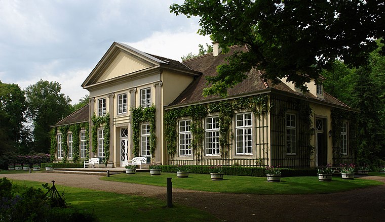
Photo: Godewind, CC BY-SA 3.0 de.
Gut Landruhe is situated 230 metres southwest of Rettung durch eine Rippe!.
Gut Landruhe, Hofmeierhaus
Building

Photo: Godewind, CC BY-SA 3.0 de.
Gut Landruhe, Hofmeierhaus is a building, which is situated 160 metres south of Rettung durch eine Rippe!.
Thalia
Work of art

Photo: Godewind, CC BY-SA 3.0 de.
Thalia is a work of art, which is situated 260 metres southwest of Rettung durch eine Rippe!.
Places in the Area
Nearby places include Horn-Lehe and Borgfeld.

Borgfeld
Suburb

Photo: Joern M, CC BY-SA 3.0.
Borgfeld is a suburb, which is situated 3 km north of Rettung durch eine Rippe!.
Bremen-Vahr
Suburb

Photo: Pilot71, CC BY-SA 3.0.
Vahr is a district of Bremen and belongs to the Bremen district East. Vahr is located about 5 km east of the center of Bremen. The neighboring districts are Oberneuland in the north, Osterholz in the east, Hemelingen in the southeast, the eastern suburb in the southwest, Schwachhausen in the west and Horn-Lehe in the northwest. Bremen-Vahr is situated 3 km southwest of Rettung durch eine Rippe!.
Rettung durch eine Rippe!
- Type: Sign
- Categories: information and tourism
- Location: Bremen, City state Bremen, Germany, Central Europe, Europe
- View on OpenStreetMap
Latitude
53.101° or 53° 6′ 4″ northLongitude
8.89721° or 8° 53′ 50″ eastOperator
Umweltbetrieb BremenOpen location code
9F5C4V2W+CVOpenStreetMap ID
node 5295194642OpenStreetMap feature
tourism=information
This page is based on OpenStreetMap, Wikidata, and Wikimedia Commons.
We’d love your help improving our open data sources. Thank you for contributing.
Satellite Map
Discover Rettung durch eine Rippe! from above in high-definition satellite imagery.
Notable Places Nearby
Highlights include Menke Park and Orangerie.
Nearby Places
Explore places such as Wer hat von meinem Tellerchen gegessen? and Ein Platz an der Sonne.
Germany: Must-Visit Destinations
Delve into Berlin, Munich, Hamburg, and Frankfurt.
Curious Places to Discover
Uncover intriguing places from every corner of the globe.
About Mapcarta. Data © OpenStreetMap contributors and available under the Open Database License". Text is available under the CC BY-SA 4.0 license, except for photos, directions, and the map. Photo: Dschwen, CC BY-SA 3.0.